Mekarjaya geodata
Mekarjaya (West Java) is a seat of a fourth-order administrative division; located in Indonesia in Asia/Jakarta (GMT+7) time zone. In our database, there are 407 cities with bigger population. Compared to other cities in Indonesia, 51.1% of cities are located further ↓South; 84.2% of cities are located further →East and 97.6% of cities have lower elevation than Mekarjaya. Note1


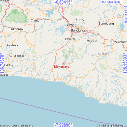
Mekarjaya GPS coordinates[2]
7° 18' 7.56" South, 107° 26' 48.84" East
| Map corner | latitude | longitude |
|---|---|---|
| Upper-left | -6.60415°, | 106.74378° |
| Center: | -7.3021°, | 107.4469° |
| Lower-right: | -7.99896°, | 108.15003° |
| Map W x H: | 155.1×155.1 km | = 96.4×96.4mi |
| max Lat: | 5.88969° ⇑48.9% North |
| Mekarjaya: | -7.3021° |
| min Lat: | ⇓51.1% South -10.934° |
| min Long | Mekarjaya | max Long |
| 95.1345° | 107.4469° | 140.9419° |
| W 15.8%⇐ | ⇒84.2% E |
Elevation
Elevation of Mekarjaya is 1006 m = 3301 ft, and this is 776.3 m = 2547 ft above average elevation for this country.
| Max E: |
3185 m = 10449 ft | 2.4% |
| Mekarjaya | 1006 m 3301 ft | |
| Avg. | 229.7 m = 754 ft | |
Min E: |
-1 m = -3 ft | 97.6% |
See also: Indonesia elevation on elevation.city.
Geographical zone
Mekarjaya is located in South Torrid zone (between Equator and Tropic of Capricorn). Distance of Equator is 811.9 km =504.5 mi to North.| Distance of | km | miles | from Mekarjaya |
|---|---|---|---|
| Equator | 811.9 | 504.5 | to North |
| Tropic Capricorn | 1794 | 1114.7 | to South |
| Antarctic Circle | 6589.3 | 4094.4 | to South |
| South Pole | 9195.1 | 5713.6 | to South |


Nearby cities:
15 places around Mekarjaya: (largest is in red/bold)
• Balegede
10.8 km =6.7 mi,  293°
293°
• Cibuluh
6.9 km =4.3 mi,  170°
170°
• Cibungur
9.5 km =5.9 mi,  82°
82°
• Cihaur
9.2 km =5.7 mi,  94°
94°
• Cinyumput
11.4 km =7.1 mi,  142°
142°
• Cisewu
9.9 km =6.2 mi,  145°
145°
• Genteng
5.4 km =3.4 mi, 86°
• Mancagahar
6.7 km =4.2 mi,  116°
116°
• Mitrabakti
9.9 km =6.2 mi,  280°
280°
• Pasirangin Satu
11.4 km =7.1 mi, 77°
• Pasirjambu
10.7 km =6.6 mi,  109°
109°
• Puncakbaru
3.6 km =2.2 mi,  177°
177°
• Sawahlegok
2.5 km =1.6 mi,  54°
54°
• Selaawi
4 km =2.5 mi, 119°
• Talegong Dua
7.2 km =4.5 mi, 87°
Sources, notices
• [Note1] Compared only with cities in Indonesia existing in our database
• [Src1] Map data: © OpenStreetMap contributors (CC-BY-SA)
• [Src2] Other city data from geonames.org with taken over terms of usage.
• [Src3] Geographical zone / Annual Mean Temperature by Robert A. Rohde @ Wikipedia
