Puncakbaru geodata
Puncakbaru (West Java) is a seat of a fourth-order administrative division; located in Indonesia in Asia/Jakarta (GMT+7) time zone. In our database, there are 407 cities with bigger population. Compared to other cities in Indonesia, 50.5% of cities are located further ↑North; 84.2% of cities are located further →East and 98% of cities have lower elevation than Puncakbaru. Note1


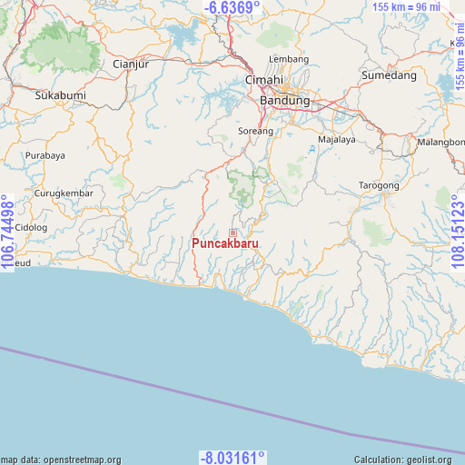
Puncakbaru GPS coordinates[2]
7° 20' 5.28" South, 107° 26' 53.16" East
| Map corner | latitude | longitude |
|---|---|---|
| Upper-left | -6.6369°, | 106.74498° |
| Center: | -7.3348°, | 107.4481° |
| Lower-right: | -8.03161°, | 108.15123° |
| Map W x H: | 155.1×155.1 km | = 96.4×96.4mi |
| max Lat: | 5.88969° ⇑50.5% North |
| Puncakbaru: | -7.3348° |
| min Lat: | ⇓49.5% South -10.934° |
| min Long | Puncakbaru | max Long |
| 95.1345° | 107.4481° | 140.9419° |
| W 15.8%⇐ | ⇒84.2% E |
Elevation
Elevation of Puncakbaru is 1034 m = 3392 ft, and this is 804.3 m = 2639 ft above average elevation for this country.
| Max E: |
3185 m = 10449 ft | 2% |
| Puncakbaru | 1034 m 3392 ft | |
| Avg. | 229.7 m = 754 ft | |
Min E: |
-1 m = -3 ft | 98% |
See also: Indonesia elevation on elevation.city.
Geographical zone
Puncakbaru is located in South Torrid zone (between Equator and Tropic of Capricorn). Distance of Equator is 815.6 km =506.8 mi to North.| Distance of | km | miles | from Puncakbaru |
|---|---|---|---|
| Equator | 815.6 | 506.8 | to North |
| Tropic Capricorn | 1790.4 | 1112.5 | to South |
| Antarctic Circle | 6585.6 | 4092.1 | to South |
| South Pole | 9191.5 | 5711.3 | to South |


Nearby cities:
15 places around Puncakbaru: (largest is in red/bold)
• Baranti
8.8 km =5.5 mi,  197°
197°
• Cibuluh
3.3 km =2.1 mi,  163°
163°
• Cibungur
10.5 km =6.5 mi,  62°
62°
• Cihaur
9.5 km =5.9 mi,  72°
72°
• Cikarang
10.2 km =6.3 mi,  176°
176°
• Cinyumput
8.7 km =5.4 mi,  128°
128°
• Cisewu
7.1 km =4.4 mi, 129°
• Genteng
6.6 km =4.1 mi,  52°
52°
• Mancagahar
5.9 km =3.7 mi,  83°
83°
• Mekarjaya
3.6 km =2.2 mi,  357°
357°
• Mitrabakti
11.3 km =7 mi,  299°
299°
• Pasirjambu
10 km =6.2 mi,  89°
89°
• Sawahlegok
5.5 km =3.4 mi,  20°
20°
• Selaawi
3.8 km =2.4 mi, 63°
• Talegong Dua
8 km =5 mi, 60°
Sources, notices
• [Note1] Compared only with cities in Indonesia existing in our database
• [Src1] Map data: © OpenStreetMap contributors (CC-BY-SA)
• [Src2] Other city data from geonames.org with taken over terms of usage.
• [Src3] Geographical zone / Annual Mean Temperature by Robert A. Rohde @ Wikipedia
