Babakantugu geodata
Babakantugu (West Java) is a seat of a fourth-order administrative division; located in Indonesia in Asia/Jakarta (GMT+7) time zone. In our database, there are 407 cities with bigger population. Compared to other cities in Indonesia, 52.8% of cities are located further ↓South; 85% of cities are located further →East and 61.2% of cities have lower elevation than Babakantugu. Note1


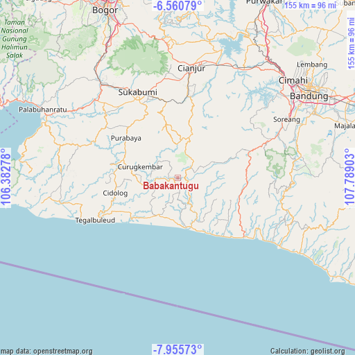
Babakantugu GPS coordinates[2]
7° 15' 31.68" South, 107° 5' 9.24" East
| Map corner | latitude | longitude |
|---|---|---|
| Upper-left | -6.56079°, | 106.38278° |
| Center: | -7.2588°, | 107.0859° |
| Lower-right: | -7.95573°, | 107.78903° |
| Map W x H: | 155.1×155.1 km | = 96.4×96.4mi |
| max Lat: | 5.88969° ⇑47.2% North |
| Babakantugu: | -7.2588° |
| min Lat: | ⇓52.8% South -10.934° |
| min Long | Babakantugu | max Long |
| 95.1345° | 107.0859° | 140.9419° |
| W 15%⇐ | ⇒85% E |
Elevation
Elevation of Babakantugu is 177 m = 581 ft, and this is 52.7 m = 173 ft below average elevation for this country.
| Max E: |
3185 m = 10449 ft | 38.8% |
| Avg. | 229.7 m = 754 ft | |
| Babakantugu | 177 m = 581 ft | |
Min E: |
-1 m = -3 ft | 61.2% |
See also: Indonesia elevation on elevation.city.
Geographical zone
Babakantugu is located in South Torrid zone (between Equator and Tropic of Capricorn). Distance of Equator is 807.1 km =501.5 mi to North.| Distance of | km | miles | from Babakantugu |
|---|---|---|---|
| Equator | 807.1 | 501.5 | to North |
| Tropic Capricorn | 1798.8 | 1117.7 | to South |
| Antarctic Circle | 6594.1 | 4097.4 | to South |
| South Pole | 9200 | 5716.6 | to South |


Nearby cities:
15 places around Babakantugu: (largest is in red/bold)
• Cibodas
4.6 km =2.9 mi,  254°
254°
• Gunungwaru Satu
4.4 km =2.7 mi,  296°
296°
• Kadupandak
4.3 km =2.7 mi,  266°
266°
• Karamat
4.2 km =2.6 mi, 270°
• Kebonkaret
2.5 km =1.6 mi,  320°
320°
• Legokbuluh
5.4 km =3.4 mi,  47°
47°
• Pasirmanggu
2.6 km =1.6 mi,  113°
113°
• Puncakwangi
4.7 km =2.9 mi,  207°
207°
• Rawawilis
2.5 km =1.6 mi,  166°
166°
• Sinarwangi
3.2 km =2 mi,  134°
134°
• Sumur
2.5 km =1.6 mi,  183°
183°
• Tanggeung
4.3 km =2.7 mi,  103°
103°
• Tanggeung Kolot
5.5 km =3.4 mi, 110°
• Tegalheras
3.1 km =1.9 mi,  224°
224°
• Tugu
3.4 km =2.1 mi, 267°
Sources, notices
• [Note1] Compared only with cities in Indonesia existing in our database
• [Src1] Map data: © OpenStreetMap contributors (CC-BY-SA)
• [Src2] Other city data from geonames.org with taken over terms of usage.
• [Src3] Geographical zone / Annual Mean Temperature by Robert A. Rohde @ Wikipedia
