Gunungwaru Satu geodata
Gunungwaru Satu (West Java) is a seat of a fourth-order administrative division; located in Indonesia in Asia/Jakarta (GMT+7) time zone. In our database, there are 407 cities with bigger population. Compared to other cities in Indonesia, 53.4% of cities are located further ↓South; 85.2% of cities are located further →East and 69.3% of cities have lower elevation than Gunungwaru Satu. Note1


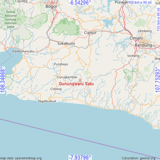
Gunungwaru Satu GPS coordinates[2]
7° 14' 27.6" South, 107° 2' 59.28" East
| Map corner | latitude | longitude |
|---|---|---|
| Upper-left | -6.54296°, | 106.34668° |
| Center: | -7.241°, | 107.0498° |
| Lower-right: | -7.93796°, | 107.75293° |
| Map W x H: | 155.1×155.1 km | = 96.4×96.4mi |
| max Lat: | 5.88969° ⇑46.6% North |
| Gunungwaru Satu: | -7.241° |
| min Lat: | ⇓53.4% South -10.934° |
| min Long | Gunungwaru Satu | max Long |
| 95.1345° | 107.0498° | 140.9419° |
| W 14.8%⇐ | ⇒85.2% E |
Elevation
Elevation of Gunungwaru Satu is 283 m = 928 ft, and this is 53.3 m = 175 ft above average elevation for this country.
| Max E: |
3185 m = 10449 ft | 30.7% |
| Gunungwaru Satu | 283 m 928 ft | |
| Avg. | 229.7 m = 754 ft | |
Min E: |
-1 m = -3 ft | 69.3% |
See also: Indonesia elevation on elevation.city.
Geographical zone
Gunungwaru Satu is located in South Torrid zone (between Equator and Tropic of Capricorn). Distance of Equator is 805.1 km =500.3 mi to North.| Distance of | km | miles | from Gunungwaru Satu |
|---|---|---|---|
| Equator | 805.1 | 500.3 | to North |
| Tropic Capricorn | 1800.8 | 1119 | to South |
| Antarctic Circle | 6596.1 | 4098.6 | to South |
| South Pole | 9201.9 | 5717.8 | to South |


Nearby cities:
15 places around Gunungwaru Satu: (largest is in red/bold)
• Babakantugu
4.4 km =2.7 mi,  116°
116°
• Bojonglarang
5.6 km =3.5 mi,  246°
246°
• Cibodas
3.2 km =2 mi,  188°
188°
• Cimanggu
2.5 km =1.6 mi,  259°
259°
• Cintasari
2.3 km =1.4 mi,  316°
316°
• Kadupandak
2.3 km =1.4 mi, 187°
• Kalapanunggal
5.8 km =3.6 mi,  300°
300°
• Kampungpasar
2.9 km =1.8 mi,  223°
223°
• Karamat
1.9 km =1.2 mi, 187°
• Kebonkaret
2.4 km =1.5 mi,  91°
91°
• Sawahrandu
3.9 km =2.4 mi,  236°
236°
• Sukakarya
4.6 km =2.9 mi,  277°
277°
• Sukasari
5.5 km =3.4 mi,  5°
5°
• Tegalheras
4.6 km =2.9 mi,  157°
157°
• Tugu
2.2 km =1.4 mi, 164°
Sources, notices
• [Note1] Compared only with cities in Indonesia existing in our database
• [Src1] Map data: © OpenStreetMap contributors (CC-BY-SA)
• [Src2] Other city data from geonames.org with taken over terms of usage.
• [Src3] Geographical zone / Annual Mean Temperature by Robert A. Rohde @ Wikipedia
