Negla geodata
Negla (West Java) is a seat of a fourth-order administrative division; located in Indonesia in Asia/Jakarta (GMT+7) time zone. In our database, there are 407 cities with bigger population. Compared to other cities in Indonesia, 52.2% of cities are located further ↓South; 83.5% of cities are located further →East and 99.9% of cities have lower elevation than Negla. Note1


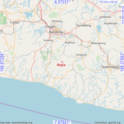
Negla GPS coordinates[2]
7° 16' 23.88" South, 107° 40' 32.52" East
| Map corner | latitude | longitude |
|---|---|---|
| Upper-left | -6.57531°, | 106.97258° |
| Center: | -7.2733°, | 107.6757° |
| Lower-right: | -7.97021°, | 108.37883° |
| Map W x H: | 155.1×155.1 km | = 96.4×96.4mi |
| max Lat: | 5.88969° ⇑47.8% North |
| Negla: | -7.2733° |
| min Lat: | ⇓52.2% South -10.934° |
| min Long | Negla | max Long |
| 95.1345° | 107.6757° | 140.9419° |
| W 16.5%⇐ | ⇒83.5% E |
Elevation
Elevation of Negla is 1787 m = 5863 ft, and this is 1557.3 m = 5109 ft above average elevation for this country.
| Max E: |
3185 m = 10449 ft | 0.099999999999994% |
| Negla | 1787 m 5863 ft | |
| Avg. | 229.7 m = 754 ft | |
Min E: |
-1 m = -3 ft | 99.9% |
See also: Indonesia elevation on elevation.city.
Geographical zone
Negla is located in South Torrid zone (between Equator and Tropic of Capricorn). Distance of Equator is 808.7 km =502.5 mi to North.| Distance of | km | miles | from Negla |
|---|---|---|---|
| Equator | 808.7 | 502.5 | to North |
| Tropic Capricorn | 1797.2 | 1116.7 | to South |
| Antarctic Circle | 6592.5 | 4096.4 | to South |
| South Pole | 9198.3 | 5715.6 | to South |


Nearby cities:
15 places around Negla: (largest is in red/bold)
• Amerta
10.8 km =6.7 mi,  92°
92°
• Cidarengdeng
12.3 km =7.6 mi,  83°
83°
• Cikandang
13.8 km =8.6 mi,  140°
140°
• Cikopo
10.8 km =6.7 mi,  180°
180°
• Cipaku
13.9 km =8.6 mi, 141°
• Ciwaru
12.4 km =7.7 mi,  100°
100°
• Gudang
13.9 km =8.6 mi,  105°
105°
• Negla
11.6 km =7.2 mi, 91°
• Paledang
13.3 km =8.3 mi, 107°
• Pangauban
11.4 km =7.1 mi, 84°
• Pangauban
14.1 km =8.8 mi, 90°
• Pasar Kidul
13.7 km =8.5 mi, 107°
• Rancabolang
14.1 km =8.8 mi, 89°
• Santosa
4.6 km =2.9 mi,  298°
298°
• Sukawangsa
13.9 km =8.6 mi, 83°
Sources, notices
• [Note1] Compared only with cities in Indonesia existing in our database
• [Src1] Map data: © OpenStreetMap contributors (CC-BY-SA)
• [Src2] Other city data from geonames.org with taken over terms of usage.
• [Src3] Geographical zone / Annual Mean Temperature by Robert A. Rohde @ Wikipedia
