Gunungsatria geodata
Gunungsatria (West Java) is a seat of a fourth-order administrative division; located in Indonesia in Asia/Jakarta (GMT+7) time zone. In our database, there are 407 cities with bigger population. Compared to other cities in Indonesia, 53.9% of cities are located further ↓South; 81.9% of cities are located further →East and 93% of cities have lower elevation than Gunungsatria. Note1


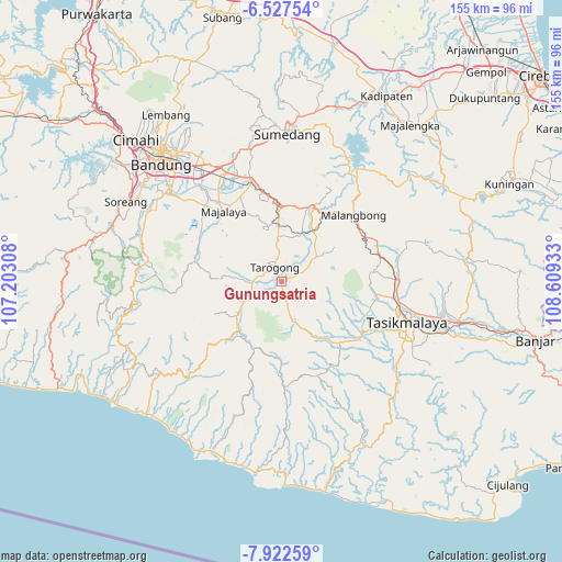
Gunungsatria GPS coordinates[2]
7° 13' 32.16" South, 107° 54' 22.32" East
| Map corner | latitude | longitude |
|---|---|---|
| Upper-left | -6.52754°, | 107.20308° |
| Center: | -7.2256°, | 107.9062° |
| Lower-right: | -7.92259°, | 108.60933° |
| Map W x H: | 155.1×155.1 km | = 96.4×96.4mi |
| max Lat: | 5.88969° ⇑46.1% North |
| Gunungsatria: | -7.2256° |
| min Lat: | ⇓53.9% South -10.934° |
| min Long | Gunungsatria | max Long |
| 95.1345° | 107.9062° | 140.9419° |
| W 18.1%⇐ | ⇒81.9% E |
Elevation
Elevation of Gunungsatria is 735 m = 2411 ft, and this is 505.3 m = 1658 ft above average elevation for this country.
| Max E: |
3185 m = 10449 ft | 7% |
| Gunungsatria | 735 m 2411 ft | |
| Avg. | 229.7 m = 754 ft | |
Min E: |
-1 m = -3 ft | 93% |
See also: Indonesia elevation on elevation.city.
Geographical zone
Gunungsatria is located in South Torrid zone (between Equator and Tropic of Capricorn). Distance of Equator is 803.4 km =499.2 mi to North.| Distance of | km | miles | from Gunungsatria |
|---|---|---|---|
| Equator | 803.4 | 499.2 | to North |
| Tropic Capricorn | 1802.5 | 1120 | to South |
| Antarctic Circle | 6597.8 | 4099.7 | to South |
| South Pole | 9203.7 | 5718.9 | to South |


Nearby cities:
15 places around Gunungsatria: (largest is in red/bold)
• Bentar Girang
1.6 km =1 mi,  20°
20°
• Besarmanah
1.6 km =1 mi,  272°
272°
• Cangkuang
0.6 km =0.4 mi,  245°
245°
• Cimaragas
2.1 km =1.3 mi,  173°
173°
• Ciwalen
1.2 km =0.7 mi, 18°
• Gugunungan
1.2 km =0.7 mi,  146°
146°
• Jangkurang Kidul
2.1 km =1.3 mi,  7°
7°
• Mawar
1.5 km =0.9 mi,  354°
354°
• Nangerang
2 km =1.2 mi,  124°
124°
• Pakuwon
1.2 km =0.7 mi, 345°
• Panunggangan
2.1 km =1.3 mi,  264°
264°
• Rengganis
1.7 km =1.1 mi,  329°
329°
• Suci Kaler
2.1 km =1.3 mi,  58°
58°
• Suci Kidul
2 km =1.2 mi, 63°
• Taluncemara
0.7 km =0.4 mi, 14°
Sources, notices
• [Note1] Compared only with cities in Indonesia existing in our database
• [Src1] Map data: © OpenStreetMap contributors (CC-BY-SA)
• [Src2] Other city data from geonames.org with taken over terms of usage.
• [Src3] Geographical zone / Annual Mean Temperature by Robert A. Rohde @ Wikipedia
