Gununglimbangan geodata
Gununglimbangan (West Java) is a seat of a third-order administrative division; located in Indonesia in Asia/Jakarta (GMT+7) time zone. In our database, there are 407 cities with bigger population. Compared to other cities in Indonesia, 60.1% of cities are located further ↓South; 80.4% of cities are located further →East and 89.5% of cities have lower elevation than Gununglimbangan. Note1


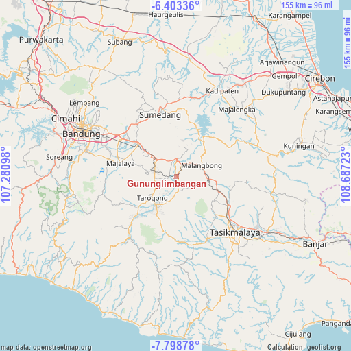
Gununglimbangan GPS coordinates[2]
7° 6' 5.76" South, 107° 59' 2.76" East
| Map corner | latitude | longitude |
|---|---|---|
| Upper-left | -6.40336°, | 107.28098° |
| Center: | -7.1016°, | 107.9841° |
| Lower-right: | -7.79878°, | 108.68723° |
| Map W x H: | 155.2×155.2 km | = 96.4×96.4mi |
| max Lat: | 5.88969° ⇑39.9% North |
| Gununglimbangan: | -7.1016° |
| min Lat: | ⇓60.1% South -10.934° |
| min Long | Gununglimbangan | max Long |
| 95.1345° | 107.9841° | 140.9419° |
| W 19.6%⇐ | ⇒80.4% E |
Elevation
Elevation of Gununglimbangan is 626 m = 2054 ft, and this is 396.3 m = 1300 ft above average elevation for this country.
| Max E: |
3185 m = 10449 ft | 10.5% |
| Gununglimbangan | 626 m 2054 ft | |
| Avg. | 229.7 m = 754 ft | |
Min E: |
-1 m = -3 ft | 89.5% |
See also: Indonesia elevation on elevation.city.
Geographical zone
Gununglimbangan is located in South Torrid zone (between Equator and Tropic of Capricorn). Distance of Equator is 789.6 km =490.6 mi to North.| Distance of | km | miles | from Gununglimbangan |
|---|---|---|---|
| Equator | 789.6 | 490.6 | to North |
| Tropic Capricorn | 1816.3 | 1128.6 | to South |
| Antarctic Circle | 6611.6 | 4108.3 | to South |
| South Pole | 9217.4 | 5727.4 | to South |


Nearby cities:
15 places around Gununglimbangan: (largest is in red/bold)
• Babakanloa
0.5 km =0.3 mi,  272°
272°
• Cibodas
0.6 km =0.4 mi,  17°
17°
• Cileles
2.5 km =1.6 mi,  352°
352°
• Ciranca
2.6 km =1.6 mi,  36°
36°
• Citambal
1.9 km =1.2 mi, 38°
• Jembatandua
3.9 km =2.4 mi,  173°
173°
• Neglasari
3 km =1.9 mi,  156°
156°
• Pasantrentengah
3.4 km =2.1 mi,  327°
327°
• Pasar
2.9 km =1.8 mi, 271°
• Pasirjengkol
2.9 km =1.8 mi, 166°
• Pasirluhur
3.3 km =2.1 mi, 265°
• Sikluk
3.8 km =2.4 mi,  224°
224°
• Sindangkerta
0.9 km =0.6 mi,  180°
180°
• Tagog
2.3 km =1.4 mi,  154°
154°
• Wanakerta
0.4 km =0.2 mi,  124°
124°
Sources, notices
• [Note1] Compared only with cities in Indonesia existing in our database
• [Src1] Map data: © OpenStreetMap contributors (CC-BY-SA)
• [Src2] Other city data from geonames.org with taken over terms of usage.
• [Src3] Geographical zone / Annual Mean Temperature by Robert A. Rohde @ Wikipedia
