Pasar geodata
Pasar (West Java) is a seat of a fourth-order administrative division; located in Indonesia in Asia/Jakarta (GMT+7) time zone. In our database, there are 407 cities with bigger population. Compared to other cities in Indonesia, 60.4% of cities are located further ↓South; 78.7% of cities are located further →East and 94.3% of cities have lower elevation than Pasar. Note1


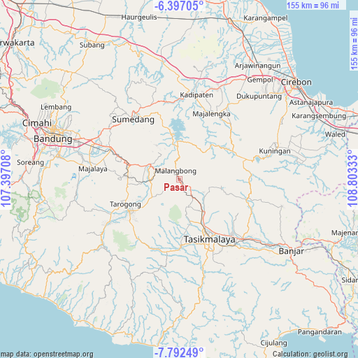
Pasar GPS coordinates[2]
7° 5' 43.08" South, 108° 6' 0.72" East
| Map corner | latitude | longitude |
|---|---|---|
| Upper-left | -6.39705°, | 107.39708° |
| Center: | -7.0953°, | 108.1002° |
| Lower-right: | -7.79249°, | 108.80333° |
| Map W x H: | 155.2×155.2 km | = 96.4×96.4mi |
| max Lat: | 5.88969° ⇑39.6% North |
| Pasar: | -7.0953° |
| min Lat: | ⇓60.4% South -10.934° |
| min Long | Pasar | max Long |
| 95.1345° | 108.1002° | 140.9419° |
| W 21.3%⇐ | ⇒78.7% E |
Elevation
Elevation of Pasar is 781 m = 2562 ft, and this is 551.3 m = 1809 ft above average elevation for this country.
| Max E: |
3185 m = 10449 ft | 5.7% |
| Pasar | 781 m 2562 ft | |
| Avg. | 229.7 m = 754 ft | |
Min E: |
-1 m = -3 ft | 94.3% |
See also: Indonesia elevation on elevation.city.
Geographical zone
Pasar is located in South Torrid zone (between Equator and Tropic of Capricorn). Distance of Equator is 788.9 km =490.2 mi to North.| Distance of | km | miles | from Pasar |
|---|---|---|---|
| Equator | 788.9 | 490.2 | to North |
| Tropic Capricorn | 1817 | 1129 | to South |
| Antarctic Circle | 6612.3 | 4108.7 | to South |
| South Pole | 9218.1 | 5727.9 | to South |


Nearby cities:
15 places around Pasar: (largest is in red/bold)
• Babakan Nyampay
5.6 km =3.5 mi,  344°
344°
• Cibugel
0.4 km =0.2 mi,  166°
166°
• Cipeuyeum
3.4 km =2.1 mi, 338°
• Citalahab
3.6 km =2.2 mi,  330°
330°
• Malangbong
4.1 km =2.5 mi, 340°
• Nanggela
5.4 km =3.4 mi,  139°
139°
• Palumbungan
3.7 km =2.3 mi,  158°
158°
• Pasarkolot
4.5 km =2.8 mi,  345°
345°
• Pasirbaros
2.2 km =1.4 mi, 344°
• Patrol
1.8 km =1.1 mi, 156°
• Saar
5.1 km =3.2 mi,  324°
324°
• Sukabatu
4.1 km =2.5 mi,  293°
293°
• Sukamulya
2.6 km =1.6 mi,  269°
269°
• Tagog
5.2 km =3.2 mi,  123°
123°
• Wage Cibahayu
3.1 km =1.9 mi, 156°
Sources, notices
• [Note1] Compared only with cities in Indonesia existing in our database
• [Src1] Map data: © OpenStreetMap contributors (CC-BY-SA)
• [Src2] Other city data from geonames.org with taken over terms of usage.
• [Src3] Geographical zone / Annual Mean Temperature by Robert A. Rohde @ Wikipedia
