Sukamandi geodata
Sukamandi (West Java) is a seat of a fourth-order administrative division; located in Indonesia in Asia/Jakarta (GMT+7) time zone. In our database, there are 407 cities with bigger population. Compared to other cities in Indonesia, 56.9% of cities are located further ↓South; 79.8% of cities are located further →East and 93.9% of cities have lower elevation than Sukamandi. Note1


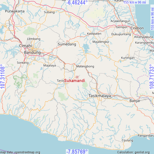
Sukamandi GPS coordinates[2]
7° 9' 38.16" South, 108° 0' 51.12" East
| Map corner | latitude | longitude |
|---|---|---|
| Upper-left | -6.46244°, | 107.31108° |
| Center: | -7.1606°, | 108.0142° |
| Lower-right: | -7.85769°, | 108.71733° |
| Map W x H: | 155.1×155.1 km | = 96.4×96.4mi |
| max Lat: | 5.88969° ⇑43.1% North |
| Sukamandi: | -7.1606° |
| min Lat: | ⇓56.9% South -10.934° |
| min Long | Sukamandi | max Long |
| 95.1345° | 108.0142° | 140.9419° |
| W 20.2%⇐ | ⇒79.8% E |
Elevation
Elevation of Sukamandi is 764 m = 2507 ft, and this is 534.3 m = 1753 ft above average elevation for this country.
| Max E: |
3185 m = 10449 ft | 6.1% |
| Sukamandi | 764 m 2507 ft | |
| Avg. | 229.7 m = 754 ft | |
Min E: |
-1 m = -3 ft | 93.9% |
See also: Indonesia elevation on elevation.city.
Geographical zone
Sukamandi is located in South Torrid zone (between Equator and Tropic of Capricorn). Distance of Equator is 796.2 km =494.7 mi to North.| Distance of | km | miles | from Sukamandi |
|---|---|---|---|
| Equator | 796.2 | 494.7 | to North |
| Tropic Capricorn | 1809.7 | 1124.5 | to South |
| Antarctic Circle | 6605 | 4104.2 | to South |
| South Pole | 9210.9 | 5723.4 | to South |


Nearby cities:
15 places around Sukamandi: (largest is in red/bold)
• Babakanloa
1.9 km =1.2 mi,  269°
269°
• Babgot
2.1 km =1.3 mi,  345°
345°
• Cibeureum
2.3 km =1.4 mi, 272°
• Cihuni Kaler
2.6 km =1.6 mi,  256°
256°
• Cikulahan
2.6 km =1.6 mi,  80°
80°
• Cipeucang
0.8 km =0.5 mi,  279°
279°
• Citangtu Kaler
2.9 km =1.8 mi,  254°
254°
• Kostarea Satu
1.7 km =1.1 mi, 345°
• Pangatikan
2.9 km =1.8 mi, 282°
• Pasanggrahan
0.7 km =0.4 mi, 245°
• Sangojar
1.9 km =1.2 mi,  110°
110°
• Sukaraja
1.6 km =1 mi, 258°
• Sukarasa
1.5 km =0.9 mi, 267°
• Sukawening
0.9 km =0.6 mi,  296°
296°
• Tegalgede
2.7 km =1.7 mi,  210°
210°
Sources, notices
• [Note1] Compared only with cities in Indonesia existing in our database
• [Src1] Map data: © OpenStreetMap contributors (CC-BY-SA)
• [Src2] Other city data from geonames.org with taken over terms of usage.
• [Src3] Geographical zone / Annual Mean Temperature by Robert A. Rohde @ Wikipedia
