Januti geodata
Januti (West Java) is a seat of a fourth-order administrative division; located in Indonesia in Asia/Jakarta (GMT+7) time zone. In our database, there are 407 cities with bigger population. Compared to other cities in Indonesia, 55.1% of cities are located further ↑North; 78.2% of cities are located further →East and 76.4% of cities have lower elevation than Januti. Note1


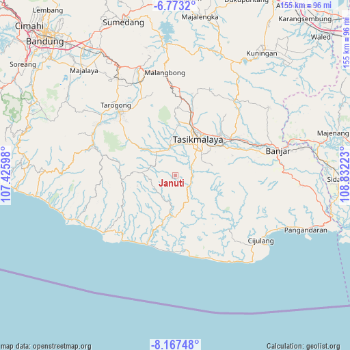
Januti GPS coordinates[2]
7° 28' 15.24" South, 108° 7' 44.76" East
| Map corner | latitude | longitude |
|---|---|---|
| Upper-left | -6.7732°, | 107.42598° |
| Center: | -7.4709°, | 108.1291° |
| Lower-right: | -8.16748°, | 108.83223° |
| Map W x H: | 155×155 km | = 96.3×96.3mi |
| max Lat: | 5.88969° ⇑55.1% North |
| Januti: | -7.4709° |
| min Lat: | ⇓44.9% South -10.934° |
| min Long | Januti | max Long |
| 95.1345° | 108.1291° | 140.9419° |
| W 21.8%⇐ | ⇒78.2% E |
Elevation
Elevation of Januti is 378 m = 1240 ft, and this is 148.3 m = 487 ft above average elevation for this country.
| Max E: |
3185 m = 10449 ft | 23.6% |
| Januti | 378 m 1240 ft | |
| Avg. | 229.7 m = 754 ft | |
Min E: |
-1 m = -3 ft | 76.4% |
See also: Indonesia elevation on elevation.city.
Geographical zone
Januti is located in South Torrid zone (between Equator and Tropic of Capricorn). Distance of Equator is 830.7 km =516.2 mi to North.| Distance of | km | miles | from Januti |
|---|---|---|---|
| Equator | 830.7 | 516.2 | to North |
| Tropic Capricorn | 1775.2 | 1103.1 | to South |
| Antarctic Circle | 6570.5 | 4082.7 | to South |
| South Pole | 9176.4 | 5701.9 | to South |


Nearby cities:
15 places around Januti: (largest is in red/bold)
• Cibungur
4.7 km =2.9 mi,  174°
174°
• Cigunung
3 km =1.9 mi,  211°
211°
• Cijoho
4.4 km =2.7 mi,  39°
39°
• Cikeusal
4.5 km =2.8 mi,  339°
339°
• Cipaingeun
4.1 km =2.5 mi,  253°
253°
• Desakolot
1.7 km =1.1 mi,  188°
188°
• Kampungbaru
3.9 km =2.4 mi,  123°
123°
• Karangsari
5.7 km =3.5 mi,  299°
299°
• Kiaranonggeng
5.3 km =3.3 mi,  16°
16°
• Kubang
2.5 km =1.6 mi, 304°
• Lengkongjaya
5.8 km =3.6 mi,  144°
144°
• Muncang
5.5 km =3.4 mi,  270°
270°
• Pakalongan
2.3 km =1.4 mi,  264°
264°
• Parungponteng
3.7 km =2.3 mi, 136°
• Raksajaya
5.4 km =3.4 mi, 247°
Sources, notices
• [Note1] Compared only with cities in Indonesia existing in our database
• [Src1] Map data: © OpenStreetMap contributors (CC-BY-SA)
• [Src2] Other city data from geonames.org with taken over terms of usage.
• [Src3] Geographical zone / Annual Mean Temperature by Robert A. Rohde @ Wikipedia
