Gunungkoneng geodata
Gunungkoneng (West Java) is a seat of a fourth-order administrative division; located in Indonesia in Asia/Jakarta (GMT+7) time zone. In our database, there are 407 cities with bigger population. Compared to other cities in Indonesia, 50.2% of cities are located further ↑North; 76.2% of cities are located further →East and 75.4% of cities have lower elevation than Gunungkoneng. Note1


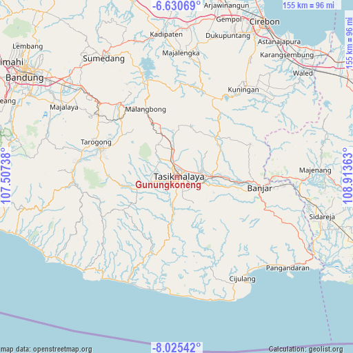
Gunungkoneng GPS coordinates[2]
7° 19' 42.96" South, 108° 12' 37.8" East
| Map corner | latitude | longitude |
|---|---|---|
| Upper-left | -6.63069°, | 107.50738° |
| Center: | -7.3286°, | 108.2105° |
| Lower-right: | -8.02542°, | 108.91363° |
| Map W x H: | 155.1×155.1 km | = 96.4×96.4mi |
| max Lat: | 5.88969° ⇑50.2% North |
| Gunungkoneng: | -7.3286° |
| min Lat: | ⇓49.8% South -10.934° |
| min Long | Gunungkoneng | max Long |
| 95.1345° | 108.2105° | 140.9419° |
| W 23.8%⇐ | ⇒76.2% E |
Elevation
Elevation of Gunungkoneng is 362 m = 1188 ft, and this is 132.3 m = 434 ft above average elevation for this country.
| Max E: |
3185 m = 10449 ft | 24.6% |
| Gunungkoneng | 362 m 1188 ft | |
| Avg. | 229.7 m = 754 ft | |
Min E: |
-1 m = -3 ft | 75.4% |
See also: Indonesia elevation on elevation.city.
Geographical zone
Gunungkoneng is located in South Torrid zone (between Equator and Tropic of Capricorn). Distance of Equator is 814.9 km =506.4 mi to North.| Distance of | km | miles | from Gunungkoneng |
|---|---|---|---|
| Equator | 814.9 | 506.4 | to North |
| Tropic Capricorn | 1791.1 | 1112.9 | to South |
| Antarctic Circle | 6586.3 | 4092.5 | to South |
| South Pole | 9192.2 | 5711.8 | to South |


Nearby cities:
15 places around Gunungkoneng: (largest is in red/bold)
• Ampera
0.7 km =0.4 mi,  2°
2°
• Argasari
0.7 km =0.4 mi,  309°
309°
• Cilingga
1.6 km =1 mi,  234°
234°
• Dadaha
1.4 km =0.9 mi,  116°
116°
• Gunungbatu
2 km =1.2 mi,  339°
339°
• Kebontiwu
1.9 km =1.2 mi,  94°
94°
• Mancogeh
2.3 km =1.4 mi,  18°
18°
• Margalaksana
2.3 km =1.4 mi,  139°
139°
• Panututan
1.4 km =0.9 mi,  187°
187°
• Sambongpari
2 km =1.2 mi,  197°
197°
• Sukasari
2.4 km =1.5 mi,  82°
82°
• Tasikmalaya
1.1 km =0.7 mi, 83°
• Tawangsari
1.3 km =0.8 mi,  59°
59°
• Tugusirna
1.8 km =1.1 mi,  161°
161°
• Yudanagara
0.7 km =0.4 mi,  109°
109°
Sources, notices
• [Note1] Compared only with cities in Indonesia existing in our database
• [Src1] Map data: © OpenStreetMap contributors (CC-BY-SA)
• [Src2] Other city data from geonames.org with taken over terms of usage.
• [Src3] Geographical zone / Annual Mean Temperature by Robert A. Rohde @ Wikipedia
