Gunungmuncang geodata
Gunungmuncang (West Java) is a seat of a fourth-order administrative division; located in Indonesia in Asia/Jakarta (GMT+7) time zone. In our database, there are 407 cities with bigger population. Compared to other cities in Indonesia, 51.3% of cities are located further ↑North; 75.6% of cities are located further →East and 74.4% of cities have lower elevation than Gunungmuncang. Note1


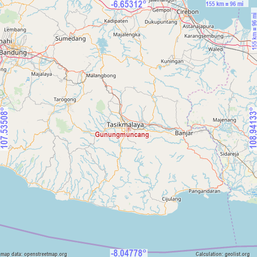
Gunungmuncang GPS coordinates[2]
7° 21' 3.6" South, 108° 14' 17.52" East
| Map corner | latitude | longitude |
|---|---|---|
| Upper-left | -6.65312°, | 107.53508° |
| Center: | -7.351°, | 108.2382° |
| Lower-right: | -8.04778°, | 108.94133° |
| Map W x H: | 155.1×155.1 km | = 96.4×96.4mi |
| max Lat: | 5.88969° ⇑51.3% North |
| Gunungmuncang: | -7.351° |
| min Lat: | ⇓48.7% South -10.934° |
| min Long | Gunungmuncang | max Long |
| 95.1345° | 108.2382° | 140.9419° |
| W 24.4%⇐ | ⇒75.6% E |
Elevation
Elevation of Gunungmuncang is 350 m = 1148 ft, and this is 120.3 m = 395 ft above average elevation for this country.
| Max E: |
3185 m = 10449 ft | 25.6% |
| Gunungmuncang | 350 m 1148 ft | |
| Avg. | 229.7 m = 754 ft | |
Min E: |
-1 m = -3 ft | 74.4% |
See also: Indonesia elevation on elevation.city.
Geographical zone
Gunungmuncang is located in South Torrid zone (between Equator and Tropic of Capricorn). Distance of Equator is 817.4 km =507.9 mi to North.| Distance of | km | miles | from Gunungmuncang |
|---|---|---|---|
| Equator | 817.4 | 507.9 | to North |
| Tropic Capricorn | 1788.6 | 1111.4 | to South |
| Antarctic Circle | 6583.8 | 4091 | to South |
| South Pole | 9189.7 | 5710.2 | to South |


Nearby cities:
15 places around Gunungmuncang: (largest is in red/bold)
• Bantargedang
1.5 km =0.9 mi,  123°
123°
• Bojongnangka
2.5 km =1.6 mi,  30°
30°
• Cikalang
1.6 km =1 mi,  327°
327°
• Condong
2.4 km =1.5 mi,  73°
73°
• Dadaha
2.6 km =1.6 mi,  316°
316°
• Kadupandak
2.8 km =1.7 mi,  145°
145°
• Kahuripan
1.2 km =0.7 mi,  291°
291°
• Kebontiwu
2.6 km =1.6 mi, 333°
• Kotabaru
2.5 km =1.6 mi,  99°
99°
• Margalaksana
1.7 km =1.1 mi,  295°
295°
• Rahayu Dua
2.4 km =1.5 mi,  188°
188°
• Saripin
2.2 km =1.4 mi,  21°
21°
• Siluman
1 km =0.6 mi,  349°
349°
• Sukamaju
2.5 km =1.6 mi,  208°
208°
• Tugusirna
2.6 km =1.6 mi, 287°
Sources, notices
• [Note1] Compared only with cities in Indonesia existing in our database
• [Src1] Map data: © OpenStreetMap contributors (CC-BY-SA)
• [Src2] Other city data from geonames.org with taken over terms of usage.
• [Src3] Geographical zone / Annual Mean Temperature by Robert A. Rohde @ Wikipedia
