Lemburwarung geodata
Lemburwarung (West Java) is a seat of a fourth-order administrative division; located in Indonesia in Asia/Jakarta (GMT+7) time zone. In our database, there are 407 cities with bigger population. Compared to other cities in Indonesia, 50.6% of cities are located further ↑North; 75.3% of cities are located further →East and 72% of cities have lower elevation than Lemburwarung. Note1


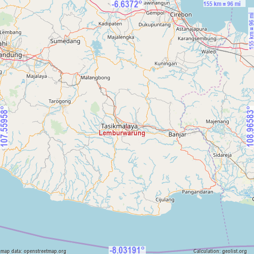
Lemburwarung GPS coordinates[2]
7° 20' 6.36" South, 108° 15' 45.72" East
| Map corner | latitude | longitude |
|---|---|---|
| Upper-left | -6.6372°, | 107.55958° |
| Center: | -7.3351°, | 108.2627° |
| Lower-right: | -8.03191°, | 108.96583° |
| Map W x H: | 155.1×155.1 km | = 96.4×96.4mi |
| max Lat: | 5.88969° ⇑50.6% North |
| Lemburwarung: | -7.3351° |
| min Lat: | ⇓49.4% South -10.934° |
| min Long | Lemburwarung | max Long |
| 95.1345° | 108.2627° | 140.9419° |
| W 24.7%⇐ | ⇒75.3% E |
Elevation
Elevation of Lemburwarung is 321 m = 1053 ft, and this is 91.3 m = 300 ft above average elevation for this country.
| Max E: |
3185 m = 10449 ft | 28% |
| Lemburwarung | 321 m 1053 ft | |
| Avg. | 229.7 m = 754 ft | |
Min E: |
-1 m = -3 ft | 72% |
See also: Indonesia elevation on elevation.city.
Geographical zone
Lemburwarung is located in South Torrid zone (between Equator and Tropic of Capricorn). Distance of Equator is 815.6 km =506.8 mi to North.| Distance of | km | miles | from Lemburwarung |
|---|---|---|---|
| Equator | 815.6 | 506.8 | to North |
| Tropic Capricorn | 1790.3 | 1112.4 | to South |
| Antarctic Circle | 6585.6 | 4092.1 | to South |
| South Pole | 9191.5 | 5711.3 | to South |


Nearby cities:
15 places around Lemburwarung: (largest is in red/bold)
• Awipari Tengah
2 km =1.2 mi,  150°
150°
• Bantargedang
3 km =1.9 mi,  208°
208°
• Bojongnangka
1.5 km =0.9 mi,  284°
284°
• Cibangun Tengah
2.7 km =1.7 mi,  173°
173°
• Cibeureum
2.4 km =1.5 mi,  161°
161°
• Cikoneng
2.7 km =1.7 mi,  19°
19°
• Cimamut
2.7 km =1.7 mi,  346°
346°
• Condong
1.1 km =0.7 mi,  200°
200°
• Gerempay
2.8 km =1.7 mi,  96°
96°
• Gunungpeundeuy
1.8 km =1.1 mi,  316°
316°
• Kertasari
2.4 km =1.5 mi,  120°
120°
• Kotabaru
2.2 km =1.4 mi,  186°
186°
• Pasar Sabtu
2.8 km =1.7 mi,  9°
9°
• Pasirjaya
1.3 km =0.8 mi,  28°
28°
• Saripin
1.9 km =1.2 mi, 278°
Sources, notices
• [Note1] Compared only with cities in Indonesia existing in our database
• [Src1] Map data: © OpenStreetMap contributors (CC-BY-SA)
• [Src2] Other city data from geonames.org with taken over terms of usage.
• [Src3] Geographical zone / Annual Mean Temperature by Robert A. Rohde @ Wikipedia
