Balengbeng geodata
Balengbeng (West Java) is a seat of a fourth-order administrative division; located in Indonesia in Asia/Jakarta (GMT+7) time zone. In our database, there are 407 cities with bigger population. Compared to other cities in Indonesia, 59.8% of cities are located further ↑North; 71.6% of cities are located further →East and 79.9% of cities have higher elevation than Balengbeng. Note1


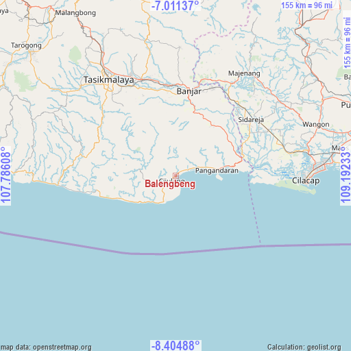
Balengbeng GPS coordinates[2]
7° 42' 31.32" South, 108° 29' 21.12" East
| Map corner | latitude | longitude |
|---|---|---|
| Upper-left | -7.01137°, | 107.78608° |
| Center: | -7.7087°, | 108.4892° |
| Lower-right: | -8.40488°, | 109.19233° |
| Map W x H: | 154.9×154.9 km | = 96.3×96.3mi |
| max Lat: | 5.88969° ⇑59.8% North |
| Balengbeng: | -7.7087° |
| min Lat: | ⇓40.2% South -10.934° |
| min Long | Balengbeng | max Long |
| 95.1345° | 108.4892° | 140.9419° |
| W 28.4%⇐ | ⇒71.6% E |
Elevation
Elevation of Balengbeng is 19 m = 62 ft, and this is 210.7 m = 691 ft below average elevation for this country.
| Max E: |
3185 m = 10449 ft | 79.9% |
| Avg. | 229.7 m = 754 ft | |
| Balengbeng | 19 m = 62 ft | |
Min E: |
-1 m = -3 ft | 20.1% |
See also: Indonesia elevation on elevation.city.
Geographical zone
Balengbeng is located in South Torrid zone (between Equator and Tropic of Capricorn). Distance of Equator is 857.1 km =532.6 mi to North.| Distance of | km | miles | from Balengbeng |
|---|---|---|---|
| Equator | 857.1 | 532.6 | to North |
| Tropic Capricorn | 1748.8 | 1086.7 | to South |
| Antarctic Circle | 6544 | 4066.3 | to South |
| South Pole | 9149.9 | 5685.5 | to South |


Nearby cities:
15 places around Balengbeng: (largest is in red/bold)
• Babakan
7.6 km =4.7 mi,  204°
204°
• Binangun
2 km =1.2 mi,  234°
234°
• Ciawi
6.2 km =3.9 mi,  15°
15°
• Cibenda
7.5 km =4.7 mi,  65°
65°
• Cijulang
2.7 km =1.7 mi,  220°
220°
• Cimerak
7.2 km =4.5 mi, 229°
• Girijaya
5.7 km =3.5 mi,  63°
63°
• Karangbenda
3 km =1.9 mi,  51°
51°
• Karangjaladri
1.6 km =1 mi, 71°
• Mandala
3.9 km =2.4 mi,  206°
206°
• Panglanjan
8 km =5 mi, 18°
• Parakan
6.3 km =3.9 mi,  343°
343°
• Parigi
1.1 km =0.7 mi,  43°
43°
• Sukasari
9 km =5.6 mi, 50°
• Tenjolaya
4.7 km =2.9 mi,  260°
260°
Sources, notices
• [Note1] Compared only with cities in Indonesia existing in our database
• [Src1] Map data: © OpenStreetMap contributors (CC-BY-SA)
• [Src2] Other city data from geonames.org with taken over terms of usage.
• [Src3] Geographical zone / Annual Mean Temperature by Robert A. Rohde @ Wikipedia
