Cibenda geodata
Cibenda (West Java) is a seat of a fourth-order administrative division; located in Indonesia in Asia/Jakarta (GMT+7) time zone. In our database, there are 407 cities with bigger population. Compared to other cities in Indonesia, 59.4% of cities are located further ↑North; 70.8% of cities are located further →East and 85.2% of cities have higher elevation than Cibenda. Note1


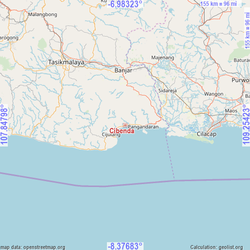
Cibenda GPS coordinates[2]
7° 40' 50.16" South, 108° 33' 3.96" East
| Map corner | latitude | longitude |
|---|---|---|
| Upper-left | -6.98323°, | 107.84798° |
| Center: | -7.6806°, | 108.5511° |
| Lower-right: | -8.37683°, | 109.25423° |
| Map W x H: | 155×155 km | = 96.3×96.3mi |
| max Lat: | 5.88969° ⇑59.4% North |
| Cibenda: | -7.6806° |
| min Lat: | ⇓40.6% South -10.934° |
| min Long | Cibenda | max Long |
| 95.1345° | 108.5511° | 140.9419° |
| W 29.2%⇐ | ⇒70.8% E |
Elevation
Elevation of Cibenda is 14 m = 46 ft, and this is 215.7 m = 708 ft below average elevation for this country.
| Max E: |
3185 m = 10449 ft | 85.2% |
| Avg. | 229.7 m = 754 ft | |
| Cibenda | 14 m = 46 ft | |
Min E: |
-1 m = -3 ft | 14.8% |
See also: Indonesia elevation on elevation.city.
Geographical zone
Cibenda is located in South Torrid zone (between Equator and Tropic of Capricorn). Distance of Equator is 854 km =530.7 mi to North.| Distance of | km | miles | from Cibenda |
|---|---|---|---|
| Equator | 854 | 530.7 | to North |
| Tropic Capricorn | 1751.9 | 1088.6 | to South |
| Antarctic Circle | 6547.2 | 4068.2 | to South |
| South Pole | 9153.1 | 5687.5 | to South |


Nearby cities:
15 places around Cibenda: (largest is in red/bold)
• Balengbeng
7.5 km =4.7 mi,  245°
245°
• Ciawi
5.9 km =3.7 mi,  299°
299°
• Cikalong
3.9 km =2.4 mi,  25°
25°
• Cipari
3 km =1.9 mi,  77°
77°
• Desa Cikambulan
6.9 km =4.3 mi, 83°
• Girijaya
1.9 km =1.2 mi, 250°
• Karangbenda
4.6 km =2.9 mi, 254°
• Karangjaladri
5.9 km =3.7 mi,  243°
243°
• Karangwangkal
7.3 km =4.5 mi,  56°
56°
• Muaratiga
8.6 km =5.3 mi, 25°
• Pajaten
7.2 km =4.5 mi,  66°
66°
• Panglanjan
6.2 km =3.9 mi,  316°
316°
• Parigi
6.5 km =4 mi, 249°
• Selasari
7.5 km =4.7 mi,  333°
333°
• Sukasari
2.5 km =1.6 mi,  3°
3°
Sources, notices
• [Note1] Compared only with cities in Indonesia existing in our database
• [Src1] Map data: © OpenStreetMap contributors (CC-BY-SA)
• [Src2] Other city data from geonames.org with taken over terms of usage.
• [Src3] Geographical zone / Annual Mean Temperature by Robert A. Rohde @ Wikipedia
