Sentul geodata
Sentul (Central Java) is a seat of a fourth-order administrative division; located in Indonesia in Asia/Jakarta (GMT+7) time zone. In our database, there are 407 cities with bigger population. Compared to other cities in Indonesia, 76.7% of cities are located further ↓South; 62.9% of cities are located further →East and 74.9% of cities have higher elevation than Sentul. Note1


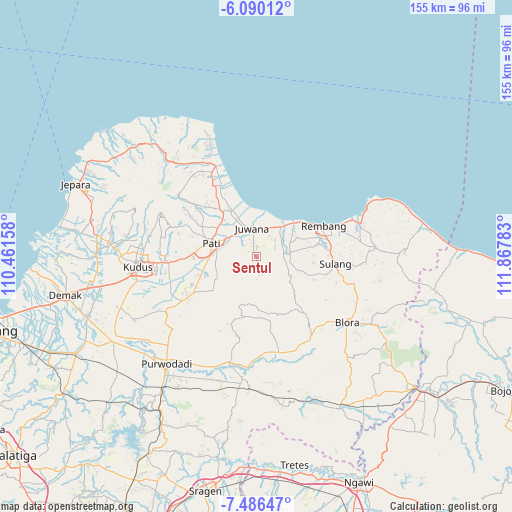
Sentul GPS coordinates[2]
6° 47' 19.68" South, 111° 9' 52.92" East
| Map corner | latitude | longitude |
|---|---|---|
| Upper-left | -6.09012°, | 110.46158° |
| Center: | -6.7888°, | 111.1647° |
| Lower-right: | -7.48647°, | 111.86783° |
| Map W x H: | 155.3×155.3 km | = 96.5×96.5mi |
| max Lat: | 5.88969° ⇑23.3% North |
| Sentul: | -6.7888° |
| min Lat: | ⇓76.7% South -10.934° |
| min Long | Sentul | max Long |
| 95.1345° | 111.1647° | 140.9419° |
| W 37.1%⇐ | ⇒62.9% E |
Elevation
Elevation of Sentul is 25 m = 82 ft, and this is 204.7 m = 672 ft below average elevation for this country.
| Max E: |
3185 m = 10449 ft | 74.9% |
| Avg. | 229.7 m = 754 ft | |
| Sentul | 25 m = 82 ft | |
Min E: |
-1 m = -3 ft | 25.1% |
See also: Indonesia elevation on elevation.city.
Geographical zone
Sentul is located in South Torrid zone (between Equator and Tropic of Capricorn). Distance of Equator is 754.8 km =469 mi to North.| Distance of | km | miles | from Sentul |
|---|---|---|---|
| Equator | 754.8 | 469 | to North |
| Tropic Capricorn | 1851.1 | 1150.2 | to South |
| Antarctic Circle | 6646.3 | 4129.8 | to South |
| South Pole | 9252.2 | 5749 | to South |


Nearby cities:
15 places around Sentul: (largest is in red/bold)
• Blingi
2.8 km =1.7 mi,  54°
54°
• Daulan
3.8 km =2.4 mi,  303°
303°
• Dersah
1.1 km =0.7 mi, 302°
• Gendolo
3.6 km =2.2 mi,  110°
110°
• Jakenan
3 km =1.9 mi,  359°
359°
• Karang Wetan
2.9 km =1.8 mi,  156°
156°
• Kemangi
3.3 km =2.1 mi,  79°
79°
• Kemiri
2.3 km =1.4 mi, 356°
• Klumpit
1 km =0.6 mi,  1°
1°
• Malangan
3.7 km =2.3 mi,  244°
244°
• Mantingantengah
2.9 km =1.8 mi, 300°
• Pengilon
3.4 km =2.1 mi,  196°
196°
• Ploso
2.4 km =1.5 mi, 237°
• Sempu
3.4 km =2.1 mi,  333°
333°
• Tegalwero
1.1 km =0.7 mi, 163°
Sources, notices
• [Note1] Compared only with cities in Indonesia existing in our database
• [Src1] Map data: © OpenStreetMap contributors (CC-BY-SA)
• [Src2] Other city data from geonames.org with taken over terms of usage.
• [Src3] Geographical zone / Annual Mean Temperature by Robert A. Rohde @ Wikipedia
