Jakenan geodata
Jakenan (Central Java) is a seat of a third-order administrative division; located in Indonesia in Asia/Jakarta (GMT+7) time zone. In our database, there are 407 cities with bigger population. Compared to other cities in Indonesia, 77.7% of cities are located further ↓South; 62.9% of cities are located further →East and 81.9% of cities have higher elevation than Jakenan. Note1


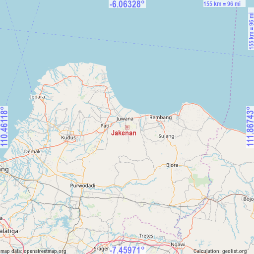
Jakenan GPS coordinates[2]
6° 45' 43.2" South, 111° 9' 51.48" East
| Map corner | latitude | longitude |
|---|---|---|
| Upper-left | -6.06328°, | 110.46118° |
| Center: | -6.762°, | 111.1643° |
| Lower-right: | -7.45971°, | 111.86743° |
| Map W x H: | 155.3×155.3 km | = 96.5×96.5mi |
| max Lat: | 5.88969° ⇑22.3% North |
| Jakenan: | -6.762° |
| min Lat: | ⇓77.7% South -10.934° |
| min Long | Jakenan | max Long |
| 95.1345° | 111.1643° | 140.9419° |
| W 37.1%⇐ | ⇒62.9% E |
Elevation
Elevation of Jakenan is 17 m = 56 ft, and this is 212.7 m = 698 ft below average elevation for this country.
| Max E: |
3185 m = 10449 ft | 81.9% |
| Avg. | 229.7 m = 754 ft | |
| Jakenan | 17 m = 56 ft | |
Min E: |
-1 m = -3 ft | 18.1% |
See also: Indonesia elevation on elevation.city.
Geographical zone
Jakenan is located in South Torrid zone (between Equator and Tropic of Capricorn). Distance of Equator is 751.9 km =467.2 mi to North.| Distance of | km | miles | from Jakenan |
|---|---|---|---|
| Equator | 751.9 | 467.2 | to North |
| Tropic Capricorn | 1854.1 | 1152.1 | to South |
| Antarctic Circle | 6649.3 | 4131.7 | to South |
| South Pole | 9255.2 | 5750.9 | to South |


Nearby cities:
15 places around Jakenan: (largest is in red/bold)
• Batur Kidul
3.2 km =2 mi,  279°
279°
• Beringin
2.3 km =1.4 mi,  331°
331°
• Blingi
2.7 km =1.7 mi,  119°
119°
• Daulan
3.2 km =2 mi,  253°
253°
• Dersah
2.6 km =1.6 mi,  199°
199°
• Genetan
1.1 km =0.7 mi,  323°
323°
• Kebonturi
2.2 km =1.4 mi,  81°
81°
• Kemiri
0.7 km =0.4 mi,  187°
187°
• Klumpit
2 km =1.2 mi,  177°
177°
• Mantingantengah
2.9 km =1.8 mi,  237°
237°
• Plosojenar
2 km =1.2 mi,  44°
44°
• Sejomulyo
3.2 km =2 mi,  312°
312°
• Sempu
1.5 km =0.9 mi,  271°
271°
• Sentul
3 km =1.9 mi, 179°
• Tlogomojo
2.4 km =1.5 mi,  22°
22°
Sources, notices
• [Note1] Compared only with cities in Indonesia existing in our database
• [Src1] Map data: © OpenStreetMap contributors (CC-BY-SA)
• [Src2] Other city data from geonames.org with taken over terms of usage.
• [Src3] Geographical zone / Annual Mean Temperature by Robert A. Rohde @ Wikipedia
