Krajan Langenharjo geodata
Krajan Langenharjo (Central Java) is a seat of a fourth-order administrative division; located in Indonesia in Asia/Jakarta (GMT+7) time zone. In our database, there are 407 cities with bigger population. Compared to other cities in Indonesia, 82.2% of cities are located further ↓South; 63.7% of cities are located further →East and 97.2% of cities have higher elevation than Krajan Langenharjo. Note1


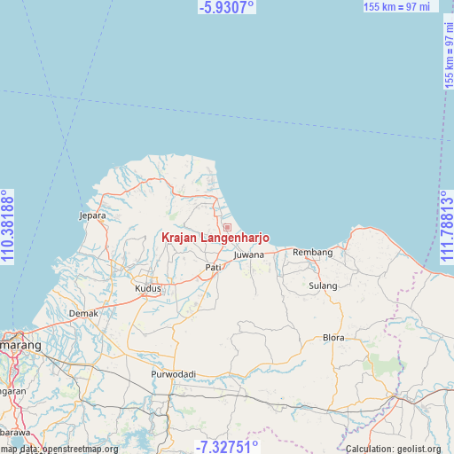
Krajan Langenharjo GPS coordinates[2]
6° 37' 46.56" South, 111° 5' 6" East
| Map corner | latitude | longitude |
|---|---|---|
| Upper-left | -5.9307°, | 110.38188° |
| Center: | -6.6296°, | 111.085° |
| Lower-right: | -7.32751°, | 111.78813° |
| Map W x H: | 155.3×155.3 km | = 96.5×96.5mi |
| max Lat: | 5.88969° ⇑17.8% North |
| Krajan Langenharjo: | -6.6296° |
| min Lat: | ⇓82.2% South -10.934° |
| min Long | Krajan Langenha | max Long |
| 95.1345° | 111.085° | 140.9419° |
| W 36.3%⇐ | ⇒63.7% E |
Elevation
Elevation of Krajan Langenharjo is 6 m = 20 ft, and this is 223.7 m = 734 ft below average elevation for this country.
| Max E: |
3185 m = 10449 ft | 97.2% |
| Avg. | 229.7 m = 754 ft | |
| Krajan Langenharjo | 6 m = 20 ft | |
Min E: |
-1 m = -3 ft | 2.8% |
See also: Indonesia elevation on elevation.city.
Geographical zone
Krajan Langenharjo is located in South Torrid zone (between Equator and Tropic of Capricorn). Distance of Equator is 737.1 km =458 mi to North.| Distance of | km | miles | from Krajan Langenharjo |
|---|---|---|---|
| Equator | 737.1 | 458 | to North |
| Tropic Capricorn | 1868.8 | 1161.2 | to South |
| Antarctic Circle | 6664 | 4140.8 | to South |
| South Pole | 9269.9 | 5760 | to South |


Nearby cities:
15 places around Krajan Langenharjo: (largest is in red/bold)
• Bonagung
3.5 km =2.2 mi,  173°
173°
• Bulumanis Kidul
2.6 km =1.6 mi,  316°
316°
• Bulumanis Lor
3.1 km =1.9 mi, 319°
• Geneng
3.1 km =1.9 mi,  154°
154°
• Kadilangu
1.9 km =1.2 mi,  175°
175°
• Ketanen
3.6 km =2.2 mi,  221°
221°
• Krajan Karangwage
2.2 km =1.4 mi, 224°
• Krandan
2.5 km =1.6 mi, 184°
• Pangkalan
1.5 km =0.9 mi,  329°
329°
• Pohbango
2.9 km =1.8 mi,  240°
240°
• Pohijo
1.5 km =0.9 mi,  282°
282°
• Rejoso
3.6 km =2.2 mi,  207°
207°
• Sekarjalak
2.8 km =1.7 mi,  310°
310°
• Tapen
1.1 km =0.7 mi,  198°
198°
• Tlutup
2.2 km =1.4 mi, 168°
Sources, notices
• [Note1] Compared only with cities in Indonesia existing in our database
• [Src1] Map data: © OpenStreetMap contributors (CC-BY-SA)
• [Src2] Other city data from geonames.org with taken over terms of usage.
• [Src3] Geographical zone / Annual Mean Temperature by Robert A. Rohde @ Wikipedia
