Ngepungkrajan geodata
Ngepungkrajan (Central Java) is a seat of a fourth-order administrative division; located in Indonesia in Asia/Jakarta (GMT+7) time zone. In our database, there are 407 cities with bigger population. Compared to other cities in Indonesia, 79.6% of cities are located further ↓South; 63.8% of cities are located further →East and 86.4% of cities have higher elevation than Ngepungkrajan. Note1


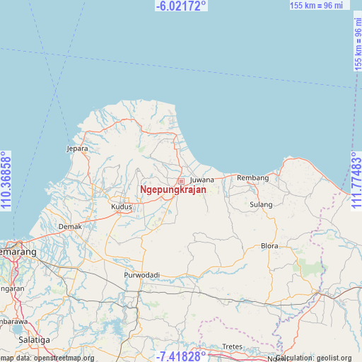
Ngepungkrajan GPS coordinates[2]
6° 43' 13.8" South, 111° 4' 18.12" East
| Map corner | latitude | longitude |
|---|---|---|
| Upper-left | -6.02172°, | 110.36858° |
| Center: | -6.7205°, | 111.0717° |
| Lower-right: | -7.41828°, | 111.77483° |
| Map W x H: | 155.3×155.3 km | = 96.5×96.5mi |
| max Lat: | 5.88969° ⇑20.4% North |
| Ngepungkrajan: | -6.7205° |
| min Lat: | ⇓79.6% South -10.934° |
| min Long | Ngepungkrajan | max Long |
| 95.1345° | 111.0717° | 140.9419° |
| W 36.2%⇐ | ⇒63.8% E |
Elevation
Elevation of Ngepungkrajan is 13 m = 43 ft, and this is 216.7 m = 711 ft below average elevation for this country.
| Max E: |
3185 m = 10449 ft | 86.4% |
| Avg. | 229.7 m = 754 ft | |
| Ngepungkrajan | 13 m = 43 ft | |
Min E: |
-1 m = -3 ft | 13.6% |
See also: Indonesia elevation on elevation.city.
Geographical zone
Ngepungkrajan is located in South Torrid zone (between Equator and Tropic of Capricorn). Distance of Equator is 747.2 km =464.3 mi to North.| Distance of | km | miles | from Ngepungkrajan |
|---|---|---|---|
| Equator | 747.2 | 464.3 | to North |
| Tropic Capricorn | 1858.7 | 1154.9 | to South |
| Antarctic Circle | 6653.9 | 4134.5 | to South |
| South Pole | 9259.8 | 5753.8 | to South |


Nearby cities:
15 places around Ngepungkrajan: (largest is in red/bold)
• Bapoh
2.1 km =1.3 mi,  304°
304°
• Bongsri
2.6 km =1.6 mi,  251°
251°
• Jontro
3.2 km =2 mi,  358°
358°
• Karanganyar
2 km =1.2 mi,  41°
41°
• Kebonagung
1.1 km =0.7 mi,  331°
331°
• Lambangan
3.1 km =1.9 mi,  187°
187°
• Ngulaan
2.1 km =1.3 mi,  342°
342°
• Ngurenrejo
2.9 km =1.8 mi,  22°
22°
• Ngurensiti
2.9 km =1.8 mi,  34°
34°
• Payang
1.6 km =1 mi,  236°
236°
• Pondohan
1.7 km =1.1 mi,  129°
129°
• Runting
2.1 km =1.3 mi,  265°
265°
• Tambakromo
0.7 km =0.4 mi,  216°
216°
• Triwil
3.1 km =1.9 mi,  89°
89°
• Widorokandang
2.4 km =1.5 mi,  160°
160°
Sources, notices
• [Note1] Compared only with cities in Indonesia existing in our database
• [Src1] Map data: © OpenStreetMap contributors (CC-BY-SA)
• [Src2] Other city data from geonames.org with taken over terms of usage.
• [Src3] Geographical zone / Annual Mean Temperature by Robert A. Rohde @ Wikipedia
