Kaborongan geodata
Kaborongan (Central Java) is a seat of a fourth-order administrative division; located in Indonesia in Asia/Jakarta (GMT+7) time zone. In our database, there are 407 cities with bigger population. Compared to other cities in Indonesia, 78.4% of cities are located further ↓South; 64.4% of cities are located further →East and 84.2% of cities have higher elevation than Kaborongan. Note1


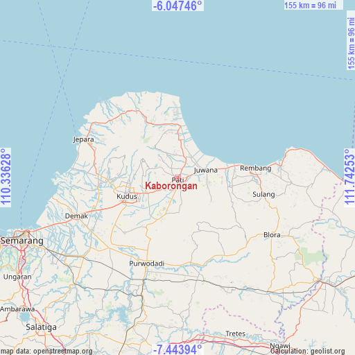
Kaborongan GPS coordinates[2]
6° 44' 46.32" South, 111° 2' 21.84" East
| Map corner | latitude | longitude |
|---|---|---|
| Upper-left | -6.04746°, | 110.33628° |
| Center: | -6.7462°, | 111.0394° |
| Lower-right: | -7.44394°, | 111.74253° |
| Map W x H: | 155.3×155.3 km | = 96.5×96.5mi |
| max Lat: | 5.88969° ⇑21.6% North |
| Kaborongan: | -6.7462° |
| min Lat: | ⇓78.4% South -10.934° |
| min Long | Kaborongan | max Long |
| 95.1345° | 111.0394° | 140.9419° |
| W 35.6%⇐ | ⇒64.4% E |
Elevation
Elevation of Kaborongan is 15 m = 49 ft, and this is 214.7 m = 704 ft below average elevation for this country.
| Max E: |
3185 m = 10449 ft | 84.2% |
| Avg. | 229.7 m = 754 ft | |
| Kaborongan | 15 m = 49 ft | |
Min E: |
-1 m = -3 ft | 15.8% |
See also: Indonesia elevation on elevation.city.
Geographical zone
Kaborongan is located in South Torrid zone (between Equator and Tropic of Capricorn). Distance of Equator is 750.1 km =466.1 mi to North.| Distance of | km | miles | from Kaborongan |
|---|---|---|---|
| Equator | 750.1 | 466.1 | to North |
| Tropic Capricorn | 1855.8 | 1153.1 | to South |
| Antarctic Circle | 6651.1 | 4132.8 | to South |
| South Pole | 9257 | 5752 | to South |


Nearby cities:
15 places around Kaborongan: (largest is in red/bold)
• Baran
1.7 km =1.1 mi,  121°
121°
• Bongsri
2.3 km =1.4 mi,  27°
27°
• Gemiring
2.7 km =1.7 mi,  253°
253°
• Geritan
2.4 km =1.5 mi,  106°
106°
• Jambean
1.1 km =0.7 mi,  335°
335°
• Karangdowo
1 km =0.6 mi, 25°
• Krajan Gajahmati
1.9 km =1.2 mi,  157°
157°
• Ngarus
0.9 km =0.6 mi,  311°
311°
• Parenggan
0.4 km =0.2 mi,  101°
101°
• Pati
1.1 km =0.7 mi,  188°
188°
• Payang
3 km =1.9 mi,  48°
48°
• Puri
1.6 km =1 mi,  259°
259°
• Runting
3.1 km =1.9 mi, 28°
• Sarirejo
1.3 km =0.8 mi, 95°
• Winong
1 km =0.6 mi,  280°
280°
Sources, notices
• [Note1] Compared only with cities in Indonesia existing in our database
• [Src1] Map data: © OpenStreetMap contributors (CC-BY-SA)
• [Src2] Other city data from geonames.org with taken over terms of usage.
• [Src3] Geographical zone / Annual Mean Temperature by Robert A. Rohde @ Wikipedia
