Kedungringin geodata
Kedungringin (Central Java) is a seat of a fourth-order administrative division; located in Indonesia in Asia/Jakarta (GMT+7) time zone. In our database, there are 407 cities with bigger population. Compared to other cities in Indonesia, 67% of cities are located further ↓South; 60.9% of cities are located further →East and 54.8% of cities have higher elevation than Kedungringin. Note1


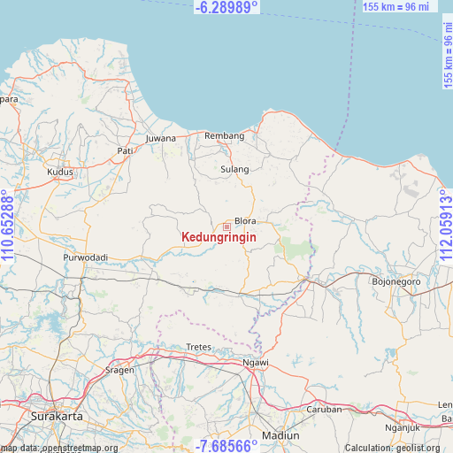
Kedungringin GPS coordinates[2]
6° 59' 17.88" South, 111° 21' 21.6" East
| Map corner | latitude | longitude |
|---|---|---|
| Upper-left | -6.28989°, | 110.65288° |
| Center: | -6.9883°, | 111.356° |
| Lower-right: | -7.68566°, | 112.05913° |
| Map W x H: | 155.2×155.2 km | = 96.4×96.4mi |
| max Lat: | 5.88969° ⇑33% North |
| Kedungringin: | -6.9883° |
| min Lat: | ⇓67% South -10.934° |
| min Long | Kedungringin | max Long |
| 95.1345° | 111.356° | 140.9419° |
| W 39.1%⇐ | ⇒60.9% E |
Elevation
Elevation of Kedungringin is 86 m = 282 ft, and this is 143.7 m = 471 ft below average elevation for this country.
| Max E: |
3185 m = 10449 ft | 54.8% |
| Avg. | 229.7 m = 754 ft | |
| Kedungringin | 86 m = 282 ft | |
Min E: |
-1 m = -3 ft | 45.2% |
See also: Indonesia elevation on elevation.city.
Geographical zone
Kedungringin is located in South Torrid zone (between Equator and Tropic of Capricorn). Distance of Equator is 777 km =482.8 mi to North.| Distance of | km | miles | from Kedungringin |
|---|---|---|---|
| Equator | 777 | 482.8 | to North |
| Tropic Capricorn | 1828.9 | 1136.4 | to South |
| Antarctic Circle | 6624.1 | 4116 | to South |
| South Pole | 9230 | 5735.3 | to South |


Nearby cities:
15 places around Kedungringin: (largest is in red/bold)
• Balongrejo
2.9 km =1.8 mi,  144°
144°
• Boto
4.1 km =2.5 mi,  115°
115°
• Karangtalun
3.6 km =2.2 mi,  188°
188°
• Kembang
1.2 km =0.7 mi,  204°
204°
• Kulonkali
2.1 km =1.3 mi,  96°
96°
• Maguwon
3.4 km =2.1 mi,  43°
43°
• Pruntusan
2.1 km =1.3 mi,  209°
209°
• Pudak
3.3 km =2.1 mi,  269°
269°
• Sembung
2.5 km =1.6 mi, 35°
• Sembungin
1.9 km =1.2 mi,  134°
134°
• Sendangsari
2.4 km =1.5 mi,  289°
289°
• Tawangsari
2.1 km =1.3 mi,  317°
317°
• Triteh
3.3 km =2.1 mi,  11°
11°
• Tutup
4.3 km =2.7 mi,  62°
62°
• Wantil
4 km =2.5 mi, 292°
Sources, notices
• [Note1] Compared only with cities in Indonesia existing in our database
• [Src1] Map data: © OpenStreetMap contributors (CC-BY-SA)
• [Src2] Other city data from geonames.org with taken over terms of usage.
• [Src3] Geographical zone / Annual Mean Temperature by Robert A. Rohde @ Wikipedia
