Trahan Wetan geodata
Trahan Wetan (Central Java) is a seat of a fourth-order administrative division; located in Indonesia in Asia/Jakarta (GMT+7) time zone. In our database, there are 407 cities with bigger population. Compared to other cities in Indonesia, 82.1% of cities are located further ↓South; 58.3% of cities are located further →East and 85.2% of cities have higher elevation than Trahan Wetan. Note1


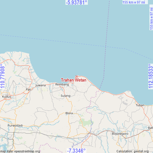
Trahan Wetan GPS coordinates[2]
6° 38' 12.12" South, 111° 28' 55.92" East
| Map corner | latitude | longitude |
|---|---|---|
| Upper-left | -5.93781°, | 110.77908° |
| Center: | -6.6367°, | 111.4822° |
| Lower-right: | -7.3346°, | 112.18533° |
| Map W x H: | 155.3×155.3 km | = 96.5×96.5mi |
| max Lat: | 5.88969° ⇑17.9% North |
| Trahan Wetan: | -6.6367° |
| min Lat: | ⇓82.1% South -10.934° |
| min Long | Trahan Wetan | max Long |
| 95.1345° | 111.4822° | 140.9419° |
| W 41.7%⇐ | ⇒58.3% E |
Elevation
Elevation of Trahan Wetan is 14 m = 46 ft, and this is 215.7 m = 708 ft below average elevation for this country.
| Max E: |
3185 m = 10449 ft | 85.2% |
| Avg. | 229.7 m = 754 ft | |
| Trahan Wetan | 14 m = 46 ft | |
Min E: |
-1 m = -3 ft | 14.8% |
See also: Indonesia elevation on elevation.city.
Geographical zone
Trahan Wetan is located in South Torrid zone (between Equator and Tropic of Capricorn). Distance of Equator is 737.9 km =458.5 mi to North.| Distance of | km | miles | from Trahan Wetan |
|---|---|---|---|
| Equator | 737.9 | 458.5 | to North |
| Tropic Capricorn | 1868 | 1160.7 | to South |
| Antarctic Circle | 6663.2 | 4140.3 | to South |
| South Pole | 9269.1 | 5759.5 | to South |


Nearby cities:
15 places around Trahan Wetan: (largest is in red/bold)
• Bendan
5.7 km =3.5 mi,  204°
204°
• Bonang
3.3 km =2.1 mi,  211°
211°
• Dukoh
1.7 km =1.1 mi,  215°
215°
• Jatisari
2.9 km =1.8 mi,  82°
82°
• Jurangjero
1 km =0.6 mi,  173°
173°
• Kalilu
5.1 km =3.2 mi, 173°
• Langgar
2.8 km =1.7 mi,  119°
119°
• Leran
1.4 km =0.9 mi,  237°
237°
• Logading
3.6 km =2.2 mi,  194°
194°
• Ngenden
4.4 km =2.7 mi, 216°
• Nggambel
3.1 km =1.9 mi,  130°
130°
• Pangkalan
1.4 km =0.9 mi,  41°
41°
• Pendok
5.1 km =3.2 mi, 83°
• Rakitan
5 km =3.1 mi, 131°
• Sluke
2 km =1.2 mi, 76°
Sources, notices
• [Note1] Compared only with cities in Indonesia existing in our database
• [Src1] Map data: © OpenStreetMap contributors (CC-BY-SA)
• [Src2] Other city data from geonames.org with taken over terms of usage.
• [Src3] Geographical zone / Annual Mean Temperature by Robert A. Rohde @ Wikipedia
