Nggambel geodata
Nggambel (Central Java) is a seat of a fourth-order administrative division; located in Indonesia in Asia/Jakarta (GMT+7) time zone. In our database, there are 407 cities with bigger population. Compared to other cities in Indonesia, 81.8% of cities are located further ↓South; 57.7% of cities are located further →East and 58.8% of cities have higher elevation than Nggambel. Note1


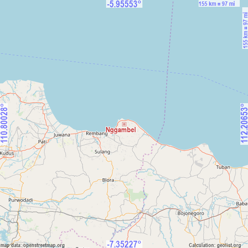
Nggambel GPS coordinates[2]
6° 39' 15.84" South, 111° 30' 12.24" East
| Map corner | latitude | longitude |
|---|---|---|
| Upper-left | -5.95553°, | 110.80028° |
| Center: | -6.6544°, | 111.5034° |
| Lower-right: | -7.35227°, | 112.20653° |
| Map W x H: | 155.3×155.3 km | = 96.5×96.5mi |
| max Lat: | 5.88969° ⇑18.2% North |
| Nggambel: | -6.6544° |
| min Lat: | ⇓81.8% South -10.934° |
| min Long | Nggambel | max Long |
| 95.1345° | 111.5034° | 140.9419° |
| W 42.3%⇐ | ⇒57.7% E |
Elevation
Elevation of Nggambel is 64 m = 210 ft, and this is 165.7 m = 544 ft below average elevation for this country.
| Max E: |
3185 m = 10449 ft | 58.8% |
| Avg. | 229.7 m = 754 ft | |
| Nggambel | 64 m = 210 ft | |
Min E: |
-1 m = -3 ft | 41.2% |
See also: Indonesia elevation on elevation.city.
Geographical zone
Nggambel is located in South Torrid zone (between Equator and Tropic of Capricorn). Distance of Equator is 739.9 km =459.8 mi to North.| Distance of | km | miles | from Nggambel |
|---|---|---|---|
| Equator | 739.9 | 459.8 | to North |
| Tropic Capricorn | 1866 | 1159.5 | to South |
| Antarctic Circle | 6661.3 | 4139.1 | to South |
| South Pole | 9267.2 | 5758.4 | to South |


Nearby cities:
15 places around Nggambel: (largest is in red/bold)
• Bendo
3.4 km =2.1 mi,  98°
98°
• Blimbing
4.3 km =2.7 mi,  58°
58°
• Bonang
4.1 km =2.5 mi,  258°
258°
• Dukoh
3.4 km =2.1 mi,  280°
280°
• Jatisari
2.4 km =1.5 mi,  13°
13°
• Jurangjero
2.4 km =1.5 mi,  293°
293°
• Kalilu
3.6 km =2.2 mi,  209°
209°
• Langgar
0.6 km =0.4 mi, 13°
• Leran
3.8 km =2.4 mi, 288°
• Logading
3.6 km =2.2 mi,  244°
244°
• Pangkalan
3.3 km =2.1 mi,  334°
334°
• Pendok
3.7 km =2.3 mi,  46°
46°
• Rakitan
2 km =1.2 mi,  134°
134°
• Sluke
2.5 km =1.6 mi,  349°
349°
• Trahan Wetan
3.1 km =1.9 mi,  310°
310°
Sources, notices
• [Note1] Compared only with cities in Indonesia existing in our database
• [Src1] Map data: © OpenStreetMap contributors (CC-BY-SA)
• [Src2] Other city data from geonames.org with taken over terms of usage.
• [Src3] Geographical zone / Annual Mean Temperature by Robert A. Rohde @ Wikipedia
