Punggurharjo geodata
Punggurharjo (Central Java) is a seat of a fourth-order administrative division; located in Indonesia in Asia/Jakarta (GMT+7) time zone. In our database, there are 407 cities with bigger population. Compared to other cities in Indonesia, 79.4% of cities are located further ↓South; 58.4% of cities are located further →East and 66.1% of cities have higher elevation than Punggurharjo. Note1


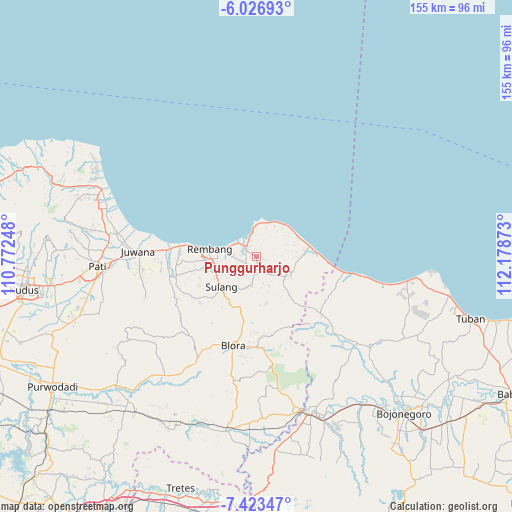
Punggurharjo GPS coordinates[2]
6° 43' 32.52" South, 111° 28' 32.16" East
| Map corner | latitude | longitude |
|---|---|---|
| Upper-left | -6.02693°, | 110.77248° |
| Center: | -6.7257°, | 111.4756° |
| Lower-right: | -7.42347°, | 112.17873° |
| Map W x H: | 155.3×155.3 km | = 96.5×96.5mi |
| max Lat: | 5.88969° ⇑20.6% North |
| Punggurharjo: | -6.7257° |
| min Lat: | ⇓79.4% South -10.934° |
| min Long | Punggurharjo | max Long |
| 95.1345° | 111.4756° | 140.9419° |
| W 41.6%⇐ | ⇒58.4% E |
Elevation
Elevation of Punggurharjo is 40 m = 131 ft, and this is 189.7 m = 622 ft below average elevation for this country.
| Max E: |
3185 m = 10449 ft | 66.1% |
| Avg. | 229.7 m = 754 ft | |
| Punggurharjo | 40 m = 131 ft | |
Min E: |
-1 m = -3 ft | 33.9% |
See also: Indonesia elevation on elevation.city.
Geographical zone
Punggurharjo is located in South Torrid zone (between Equator and Tropic of Capricorn). Distance of Equator is 747.8 km =464.7 mi to North.| Distance of | km | miles | from Punggurharjo |
|---|---|---|---|
| Equator | 747.8 | 464.7 | to North |
| Tropic Capricorn | 1858.1 | 1154.6 | to South |
| Antarctic Circle | 6653.3 | 4134.2 | to South |
| South Pole | 9259.2 | 5753.4 | to South |


Nearby cities:
15 places around Punggurharjo: (largest is in red/bold)
• Banyuurip
2.9 km =1.8 mi,  55°
55°
• Criwik
3 km =1.9 mi,  45°
45°
• Gayam
2.4 km =1.5 mi,  173°
173°
• Gemblengmulyo
1.2 km =0.7 mi,  228°
228°
• Johogunung
3.1 km =1.9 mi,  72°
72°
• Kedung
2 km =1.2 mi,  101°
101°
• Krajan Wuwur
1 km =0.6 mi, 58°
• Langkir
1.2 km =0.7 mi,  244°
244°
• Ngulangan
1.5 km =0.9 mi, 55°
• Pancur
0.9 km =0.6 mi,  300°
300°
• Pandan
2.9 km =1.8 mi,  252°
252°
• Pohlandak
2.9 km =1.8 mi, 297°
• Sambongmulyo
2.2 km =1.4 mi,  118°
118°
• Sumberagung
1.3 km =0.8 mi, 169°
• Warugunung
2.9 km =1.8 mi,  314°
314°
Sources, notices
• [Note1] Compared only with cities in Indonesia existing in our database
• [Src1] Map data: © OpenStreetMap contributors (CC-BY-SA)
• [Src2] Other city data from geonames.org with taken over terms of usage.
• [Src3] Geographical zone / Annual Mean Temperature by Robert A. Rohde @ Wikipedia
