Ngulangan geodata
Ngulangan (Central Java) is a seat of a fourth-order administrative division; located in Indonesia in Asia/Jakarta (GMT+7) time zone. In our database, there are 407 cities with bigger population. Compared to other cities in Indonesia, 79.7% of cities are located further ↓South; 58.2% of cities are located further →East and 54.8% of cities have higher elevation than Ngulangan. Note1


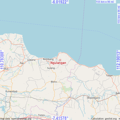
Ngulangan GPS coordinates[2]
6° 43' 4.8" South, 111° 29' 13.2" East
| Map corner | latitude | longitude |
|---|---|---|
| Upper-left | -6.01922°, | 110.78388° |
| Center: | -6.718°, | 111.487° |
| Lower-right: | -7.41578°, | 112.19013° |
| Map W x H: | 155.3×155.3 km | = 96.5×96.5mi |
| max Lat: | 5.88969° ⇑20.3% North |
| Ngulangan: | -6.718° |
| min Lat: | ⇓79.7% South -10.934° |
| min Long | Ngulangan | max Long |
| 95.1345° | 111.487° | 140.9419° |
| W 41.8%⇐ | ⇒58.2% E |
Elevation
Elevation of Ngulangan is 86 m = 282 ft, and this is 143.7 m = 471 ft below average elevation for this country.
| Max E: |
3185 m = 10449 ft | 54.8% |
| Avg. | 229.7 m = 754 ft | |
| Ngulangan | 86 m = 282 ft | |
Min E: |
-1 m = -3 ft | 45.2% |
See also: Indonesia elevation on elevation.city.
Geographical zone
Ngulangan is located in South Torrid zone (between Equator and Tropic of Capricorn). Distance of Equator is 747 km =464.2 mi to North.| Distance of | km | miles | from Ngulangan |
|---|---|---|---|
| Equator | 747 | 464.2 | to North |
| Tropic Capricorn | 1858.9 | 1155.1 | to South |
| Antarctic Circle | 6654.2 | 4134.7 | to South |
| South Pole | 9260.1 | 5754 | to South |


Nearby cities:
15 places around Ngulangan: (largest is in red/bold)
• Banyuurip
1.4 km =0.9 mi,  55°
55°
• Criwik
1.6 km =1 mi,  35°
35°
• Gemblengmulyo
2.7 km =1.7 mi,  232°
232°
• Johogunung
1.7 km =1.1 mi,  88°
88°
• Kedung
1.5 km =0.9 mi,  150°
150°
• Krajan Wuwur
0.6 km =0.4 mi, 231°
• Langkir
2.7 km =1.7 mi,  239°
239°
• Mentoro Wetan
2.1 km =1.3 mi,  10°
10°
• Ngargomulyo
2.9 km =1.8 mi,  2°
2°
• Pancur
2.1 km =1.3 mi,  259°
259°
• Punggurharjo
1.5 km =0.9 mi, 235°
• Sambongmulyo
2 km =1.2 mi,  160°
160°
• Sidowayah
2.6 km =1.6 mi,  138°
138°
• Sumberagung
2.3 km =1.4 mi,  206°
206°
• Trenggulunan
3.1 km =1.9 mi, 94°
Sources, notices
• [Note1] Compared only with cities in Indonesia existing in our database
• [Src1] Map data: © OpenStreetMap contributors (CC-BY-SA)
• [Src2] Other city data from geonames.org with taken over terms of usage.
• [Src3] Geographical zone / Annual Mean Temperature by Robert A. Rohde @ Wikipedia
