Kemadu geodata
Kemadu (Central Java) is a seat of a fourth-order administrative division; located in Indonesia in Asia/Jakarta (GMT+7) time zone. In our database, there are 407 cities with bigger population. Compared to other cities in Indonesia, 75.7% of cities are located further ↓South; 60.5% of cities are located further →East and 62.1% of cities have higher elevation than Kemadu. Note1


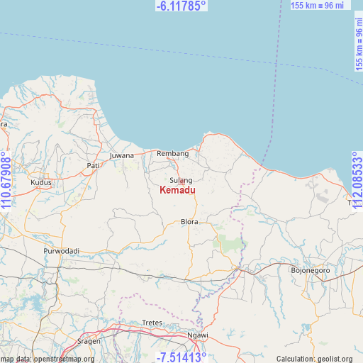
Kemadu GPS coordinates[2]
6° 48' 59.4" South, 111° 22' 55.92" East
| Map corner | latitude | longitude |
|---|---|---|
| Upper-left | -6.11785°, | 110.67908° |
| Center: | -6.8165°, | 111.3822° |
| Lower-right: | -7.51413°, | 112.08533° |
| Map W x H: | 155.3×155.3 km | = 96.5×96.5mi |
| max Lat: | 5.88969° ⇑24.3% North |
| Kemadu: | -6.8165° |
| min Lat: | ⇓75.7% South -10.934° |
| min Long | Kemadu | max Long |
| 95.1345° | 111.3822° | 140.9419° |
| W 39.5%⇐ | ⇒60.5% E |
Elevation
Elevation of Kemadu is 51 m = 167 ft, and this is 178.7 m = 586 ft below average elevation for this country.
| Max E: |
3185 m = 10449 ft | 62.1% |
| Avg. | 229.7 m = 754 ft | |
| Kemadu | 51 m = 167 ft | |
Min E: |
-1 m = -3 ft | 37.9% |
See also: Indonesia elevation on elevation.city.
Geographical zone
Kemadu is located in South Torrid zone (between Equator and Tropic of Capricorn). Distance of Equator is 757.9 km =470.9 mi to North.| Distance of | km | miles | from Kemadu |
|---|---|---|---|
| Equator | 757.9 | 470.9 | to North |
| Tropic Capricorn | 1848 | 1148.3 | to South |
| Antarctic Circle | 6643.3 | 4128 | to South |
| South Pole | 9249.1 | 5747.1 | to South |


Nearby cities:
15 places around Kemadu: (largest is in red/bold)
• Jukung
3.9 km =2.4 mi,  138°
138°
• Kaliombo Wetan
4 km =2.5 mi,  326°
326°
• Karanggeneng
3.7 km =2.3 mi,  22°
22°
• Karangori Kidul
3 km =1.9 mi,  40°
40°
• Lambangan Kulon
3.3 km =2.1 mi,  231°
231°
• Lambangan Wetan
2.2 km =1.4 mi, 231°
• Ngaglik
3.1 km =1.9 mi,  212°
212°
• Ngemplak Kidul
1.8 km =1.1 mi,  34°
34°
• Ngrojo
3.9 km =2.4 mi,  238°
238°
• Pomahan
3.4 km =2.1 mi,  84°
84°
• Ponjen
2.4 km =1.5 mi,  168°
168°
• Rukem
3.9 km =2.4 mi,  67°
67°
• Sulang Tengah
1.1 km =0.7 mi,  350°
350°
• Tanjung Utara
1.3 km =0.8 mi,  267°
267°
• Tegalsari
0.8 km =0.5 mi,  338°
338°
Sources, notices
• [Note1] Compared only with cities in Indonesia existing in our database
• [Src1] Map data: © OpenStreetMap contributors (CC-BY-SA)
• [Src2] Other city data from geonames.org with taken over terms of usage.
• [Src3] Geographical zone / Annual Mean Temperature by Robert A. Rohde @ Wikipedia
