Gendangdowo geodata
Gendangdowo (Central Java) is a seat of a fourth-order administrative division; located in Indonesia in Asia/Jakarta (GMT+7) time zone. In our database, there are 407 cities with bigger population. Compared to other cities in Indonesia, 69.7% of cities are located further ↓South; 58.9% of cities are located further →East and 50.8% of cities have higher elevation than Gendangdowo. Note1


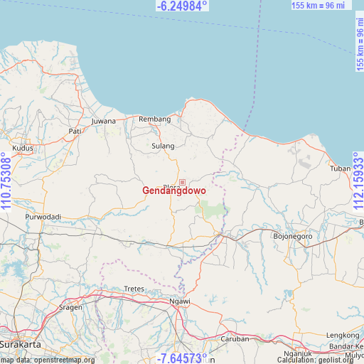
Gendangdowo GPS coordinates[2]
6° 56' 53.88" South, 111° 27' 22.32" East
| Map corner | latitude | longitude |
|---|---|---|
| Upper-left | -6.24984°, | 110.75308° |
| Center: | -6.9483°, | 111.4562° |
| Lower-right: | -7.64573°, | 112.15933° |
| Map W x H: | 155.2×155.2 km | = 96.4×96.4mi |
| max Lat: | 5.88969° ⇑30.3% North |
| Gendangdowo: | -6.9483° |
| min Lat: | ⇓69.7% South -10.934° |
| min Long | Gendangdowo | max Long |
| 95.1345° | 111.4562° | 140.9419° |
| W 41.1%⇐ | ⇒58.9% E |
Elevation
Elevation of Gendangdowo is 99 m = 325 ft, and this is 130.7 m = 429 ft below average elevation for this country.
| Max E: |
3185 m = 10449 ft | 50.8% |
| Avg. | 229.7 m = 754 ft | |
| Gendangdowo | 99 m = 325 ft | |
Min E: |
-1 m = -3 ft | 49.2% |
See also: Indonesia elevation on elevation.city.
Geographical zone
Gendangdowo is located in South Torrid zone (between Equator and Tropic of Capricorn). Distance of Equator is 772.6 km =480.1 mi to North.| Distance of | km | miles | from Gendangdowo |
|---|---|---|---|
| Equator | 772.6 | 480.1 | to North |
| Tropic Capricorn | 1833.3 | 1139.2 | to South |
| Antarctic Circle | 6628.6 | 4118.8 | to South |
| South Pole | 9234.5 | 5738.1 | to South |


Nearby cities:
15 places around Gendangdowo: (largest is in red/bold)
• Bacem
2.8 km =1.7 mi,  32°
32°
• Cangkringan
3.2 km =2 mi,  175°
175°
• Gersi
1 km =0.6 mi, 177°
• Gondang
1.9 km =1.2 mi,  154°
154°
• Jejerukrajan
3.1 km =1.9 mi,  194°
194°
• Karanggeneng
2.7 km =1.7 mi,  346°
346°
• Kawengan
2.1 km =1.3 mi,  59°
59°
• Nglaroh
1.6 km =1 mi,  198°
198°
• Nglarohgunung
3.3 km =2.1 mi,  120°
120°
• Patalan
1.3 km =0.8 mi,  290°
290°
• Puledagel
1.6 km =1 mi,  11°
11°
• Sarirejo
3.2 km =2 mi, 57°
• Seso
2.2 km =1.4 mi, 184°
• Tambaksari Satu
3.2 km =2 mi,  299°
299°
• Wonosari
2.5 km =1.6 mi,  261°
261°
Sources, notices
• [Note1] Compared only with cities in Indonesia existing in our database
• [Src1] Map data: © OpenStreetMap contributors (CC-BY-SA)
• [Src2] Other city data from geonames.org with taken over terms of usage.
• [Src3] Geographical zone / Annual Mean Temperature by Robert A. Rohde @ Wikipedia
