Ngancar geodata
Ngancar (East Java) is a seat of a fourth-order administrative division; located in Indonesia in Asia/Jakarta (GMT+7) time zone. In our database, there are 407 cities with bigger population. Compared to other cities in Indonesia, 71.2% of cities are located further ↓South; 55% of cities are located further →East and 58.8% of cities have higher elevation than Ngancar. Note1


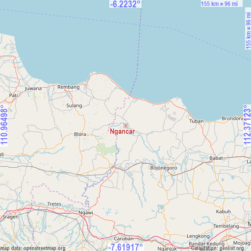
Ngancar GPS coordinates[2]
6° 55' 18.12" South, 111° 40' 5.16" East
| Map corner | latitude | longitude |
|---|---|---|
| Upper-left | -6.2232°, | 110.96498° |
| Center: | -6.9217°, | 111.6681° |
| Lower-right: | -7.61917°, | 112.37123° |
| Map W x H: | 155.2×155.2 km | = 96.4×96.4mi |
| max Lat: | 5.88969° ⇑28.8% North |
| Ngancar: | -6.9217° |
| min Lat: | ⇓71.2% South -10.934° |
| min Long | Ngancar | max Long |
| 95.1345° | 111.6681° | 140.9419° |
| W 45%⇐ | ⇒55% E |
Elevation
Elevation of Ngancar is 64 m = 210 ft, and this is 165.7 m = 544 ft below average elevation for this country.
| Max E: |
3185 m = 10449 ft | 58.8% |
| Avg. | 229.7 m = 754 ft | |
| Ngancar | 64 m = 210 ft | |
Min E: |
-1 m = -3 ft | 41.2% |
See also: Indonesia elevation on elevation.city.
Geographical zone
Ngancar is located in South Torrid zone (between Equator and Tropic of Capricorn). Distance of Equator is 769.6 km =478.2 mi to North.| Distance of | km | miles | from Ngancar |
|---|---|---|---|
| Equator | 769.6 | 478.2 | to North |
| Tropic Capricorn | 1836.3 | 1141 | to South |
| Antarctic Circle | 6631.6 | 4120.7 | to South |
| South Pole | 9237.4 | 5739.9 | to South |


Nearby cities:
15 places around Ngancar: (largest is in red/bold)
• Balong
1.4 km =0.9 mi,  318°
318°
• Dingil
4.9 km =3 mi,  67°
67°
• Jatirogo
4.1 km =2.5 mi,  346°
346°
• Jetis
4.7 km =2.9 mi,  282°
282°
• Jombok
5 km =3.1 mi,  330°
330°
• Karanggeneng
1.9 km =1.2 mi,  166°
166°
• Kejuron
5.8 km =3.6 mi,  160°
160°
• Krajan Demit
4 km =2.5 mi,  37°
37°
• Muruni
1.3 km =0.8 mi, 38°
• Ngijo
2 km =1.2 mi,  81°
81°
• Nglateng Barat
4.6 km =2.9 mi,  215°
215°
• Purwosari
3.8 km =2.4 mi, 349°
• Sadang
5.1 km =3.2 mi, 353°
• Tanggung
3.2 km =2 mi,  121°
121°
• Wotsogo
3.9 km =2.4 mi,  336°
336°
Sources, notices
• [Note1] Compared only with cities in Indonesia existing in our database
• [Src1] Map data: © OpenStreetMap contributors (CC-BY-SA)
• [Src2] Other city data from geonames.org with taken over terms of usage.
• [Src3] Geographical zone / Annual Mean Temperature by Robert A. Rohde @ Wikipedia
