Kenanti geodata
Kenanti (East Java) is a seat of a fourth-order administrative division; located in Indonesia in Asia/Jakarta (GMT+7) time zone. In our database, there are 407 cities with bigger population. Compared to other cities in Indonesia, 76.3% of cities are located further ↓South; 52.3% of cities are located further →East and 98.5% of cities have higher elevation than Kenanti. Note1


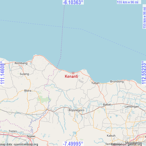
Kenanti GPS coordinates[2]
6° 48' 8.28" South, 111° 50' 57.12" East
| Map corner | latitude | longitude |
|---|---|---|
| Upper-left | -6.10363°, | 111.14608° |
| Center: | -6.8023°, | 111.8492° |
| Lower-right: | -7.49995°, | 112.55233° |
| Map W x H: | 155.3×155.3 km | = 96.5×96.5mi |
| max Lat: | 5.88969° ⇑23.7% North |
| Kenanti: | -6.8023° |
| min Lat: | ⇓76.3% South -10.934° |
| min Long | Kenanti | max Long |
| 95.1345° | 111.8492° | 140.9419° |
| W 47.7%⇐ | ⇒52.3% E |
Elevation
Elevation of Kenanti is 5 m = 16 ft, and this is 224.7 m = 737 ft below average elevation for this country.
| Max E: |
3185 m = 10449 ft | 98.5% |
| Avg. | 229.7 m = 754 ft | |
| Kenanti | 5 m = 16 ft | |
Min E: |
-1 m = -3 ft | 1.5% |
See also: Indonesia elevation on elevation.city.
Geographical zone
Kenanti is located in South Torrid zone (between Equator and Tropic of Capricorn). Distance of Equator is 756.3 km =469.9 mi to North.| Distance of | km | miles | from Kenanti |
|---|---|---|---|
| Equator | 756.3 | 469.9 | to North |
| Tropic Capricorn | 1849.6 | 1149.3 | to South |
| Antarctic Circle | 6644.8 | 4128.9 | to South |
| South Pole | 9250.7 | 5748.1 | to South |


Nearby cities:
15 places around Kenanti: (largest is in red/bold)
• Cingklung
4.3 km =2.7 mi,  256°
256°
• Dukoh
3.5 km =2.2 mi,  234°
234°
• Gadon
1.8 km =1.1 mi,  272°
272°
• Jamong
0.7 km =0.4 mi,  83°
83°
• Karangasem
4.7 km =2.9 mi,  94°
94°
• Karangrejo
1.4 km =0.9 mi, 271°
• Klutuk
2.1 km =1.3 mi,  212°
212°
• Merkawang
4.4 km =2.7 mi,  97°
97°
• Pasatan
4.4 km =2.7 mi,  239°
239°
• Pesantren
1.5 km =0.9 mi,  201°
201°
• Sobontoro
1.6 km =1 mi, 83°
• Sruki
4.3 km =2.7 mi, 262°
• Sumberejo
2.5 km =1.6 mi,  112°
112°
• Tanjang
3.2 km =2 mi, 259°
• Tawangrejo
0.7 km =0.4 mi, 269°
Sources, notices
• [Note1] Compared only with cities in Indonesia existing in our database
• [Src1] Map data: © OpenStreetMap contributors (CC-BY-SA)
• [Src2] Other city data from geonames.org with taken over terms of usage.
• [Src3] Geographical zone / Annual Mean Temperature by Robert A. Rohde @ Wikipedia
