Borehbangle geodata
Borehbangle (East Java) is a seat of a fourth-order administrative division; located in Indonesia in Asia/Jakarta (GMT+7) time zone. In our database, there are 407 cities with bigger population. Compared to other cities in Indonesia, 74.4% of cities are located further ↓South; 50.4% of cities are located further →East and 95.5% of cities have higher elevation than Borehbangle. Note1


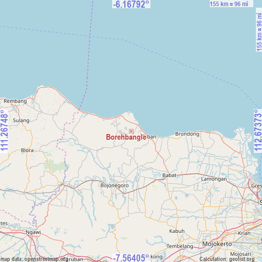
Borehbangle GPS coordinates[2]
6° 51' 59.4" South, 111° 58' 14.16" East
| Map corner | latitude | longitude |
|---|---|---|
| Upper-left | -6.16792°, | 111.26748° |
| Center: | -6.8665°, | 111.9706° |
| Lower-right: | -7.56405°, | 112.67373° |
| Map W x H: | 155.2×155.2 km | = 96.4×96.4mi |
| max Lat: | 5.88969° ⇑25.6% North |
| Borehbangle: | -6.8665° |
| min Lat: | ⇓74.4% South -10.934° |
| min Long | Borehbangle | max Long |
| 95.1345° | 111.9706° | 140.9419° |
| W 49.6%⇐ | ⇒50.4% E |
Elevation
Elevation of Borehbangle is 7 m = 23 ft, and this is 222.7 m = 731 ft below average elevation for this country.
| Max E: |
3185 m = 10449 ft | 95.5% |
| Avg. | 229.7 m = 754 ft | |
| Borehbangle | 7 m = 23 ft | |
Min E: |
-1 m = -3 ft | 4.5% |
See also: Indonesia elevation on elevation.city.
Geographical zone
Borehbangle is located in South Torrid zone (between Equator and Tropic of Capricorn). Distance of Equator is 763.5 km =474.4 mi to North.| Distance of | km | miles | from Borehbangle |
|---|---|---|---|
| Equator | 763.5 | 474.4 | to North |
| Tropic Capricorn | 1842.4 | 1144.8 | to South |
| Antarctic Circle | 6637.7 | 4124.5 | to South |
| South Pole | 9243.6 | 5743.7 | to South |


Nearby cities:
15 places around Borehbangle: (largest is in red/bold)
• Banaran
1.6 km =1 mi,  288°
288°
• Kapu
3.2 km =2 mi,  141°
141°
• Kuti
5.2 km =3.2 mi,  105°
105°
• Merakurak
2.2 km =1.4 mi,  127°
127°
• Pelang
4.1 km =2.5 mi, 142°
• Pongpongan
2.8 km =1.7 mi,  258°
258°
• Sambonggede
1.8 km =1.1 mi,  122°
122°
• Sendang
3.7 km =2.3 mi, 108°
• Senori
1.4 km =0.9 mi,  249°
249°
• Sugihan
3.6 km =2.2 mi,  323°
323°
• Sumber
1.6 km =1 mi,  60°
60°
• Suwalan
2.9 km =1.8 mi,  23°
23°
• Temandangjero
4.1 km =2.5 mi,  276°
276°
• Tuwiri Kulon
0.8 km =0.5 mi,  170°
170°
• Tuwiri Wetan
1 km =0.6 mi, 139°
Sources, notices
• [Note1] Compared only with cities in Indonesia existing in our database
• [Src1] Map data: © OpenStreetMap contributors (CC-BY-SA)
• [Src2] Other city data from geonames.org with taken over terms of usage.
• [Src3] Geographical zone / Annual Mean Temperature by Robert A. Rohde @ Wikipedia
