Cendoro Utara geodata
Cendoro Utara (East Java) is a seat of a fourth-order administrative division; located in Indonesia in Asia/Jakarta (GMT+7) time zone. In our database, there are 407 cities with bigger population. Compared to other cities in Indonesia, 70.7% of cities are located further ↓South; 51.1% of cities are located further ←West and 87.7% of cities have higher elevation than Cendoro Utara. Note1


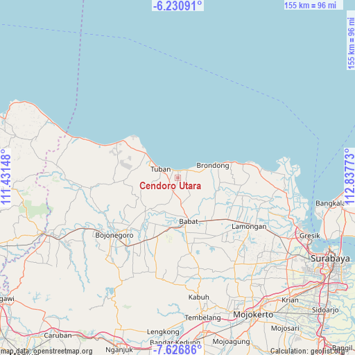
Cendoro Utara GPS coordinates[2]
6° 55' 45.84" South, 112° 8' 4.56" East
| Map corner | latitude | longitude |
|---|---|---|
| Upper-left | -6.23091°, | 111.43148° |
| Center: | -6.9294°, | 112.1346° |
| Lower-right: | -7.62686°, | 112.83773° |
| Map W x H: | 155.2×155.2 km | = 96.4×96.4mi |
| max Lat: | 5.88969° ⇑29.3% North |
| Cendoro Utara: | -6.9294° |
| min Lat: | ⇓70.7% South -10.934° |
| min Long | Cendoro Utara | max Long |
| 95.1345° | 112.1346° | 140.9419° |
| W 51.1%⇐ | ⇒48.9% E |
Elevation
Elevation of Cendoro Utara is 12 m = 39 ft, and this is 217.7 m = 714 ft below average elevation for this country.
| Max E: |
3185 m = 10449 ft | 87.7% |
| Avg. | 229.7 m = 754 ft | |
| Cendoro Utara | 12 m = 39 ft | |
Min E: |
-1 m = -3 ft | 12.3% |
See also: Indonesia elevation on elevation.city.
Geographical zone
Cendoro Utara is located in South Torrid zone (between Equator and Tropic of Capricorn). Distance of Equator is 770.5 km =478.8 mi to North.| Distance of | km | miles | from Cendoro Utara |
|---|---|---|---|
| Equator | 770.5 | 478.8 | to North |
| Tropic Capricorn | 1835.4 | 1140.5 | to South |
| Antarctic Circle | 6630.7 | 4120.1 | to South |
| South Pole | 9236.6 | 5739.4 | to South |


Nearby cities:
15 places around Cendoro Utara: (largest is in red/bold)
• Banjaranyar
3.8 km =2.4 mi,  34°
34°
• Banjarsari
3.9 km =2.4 mi,  271°
271°
• Bogorejo
2.9 km =1.8 mi, 32°
• Dawung
2.5 km =1.6 mi, 270°
• Karang Lor
4.1 km =2.5 mi,  75°
75°
• Kebondempet
4 km =2.5 mi,  251°
251°
• Krandenan
3.4 km =2.1 mi,  330°
330°
• Leran Kulon
1.9 km =1.2 mi,  68°
68°
• Leran Wetan
2.3 km =1.4 mi, 71°
• Ngimbang
3.9 km =2.4 mi,  164°
164°
• Palang Utara
3 km =1.9 mi,  11°
11°
• Pucangkrajan
1.1 km =0.7 mi,  42°
42°
• Rembes
2.9 km =1.8 mi,  2°
2°
• Sumurgung
3.9 km =2.4 mi,  306°
306°
• Wangun
3.5 km =2.2 mi,  89°
89°
Sources, notices
• [Note1] Compared only with cities in Indonesia existing in our database
• [Src1] Map data: © OpenStreetMap contributors (CC-BY-SA)
• [Src2] Other city data from geonames.org with taken over terms of usage.
• [Src3] Geographical zone / Annual Mean Temperature by Robert A. Rohde @ Wikipedia
