Palang Utara geodata
Palang Utara (East Java) is a seat of a fourth-order administrative division; located in Indonesia in Asia/Jakarta (GMT+7) time zone. In our database, there are 407 cities with bigger population. Compared to other cities in Indonesia, 72.4% of cities are located further ↓South; 51.1% of cities are located further ←West and 97.2% of cities have higher elevation than Palang Utara. Note1


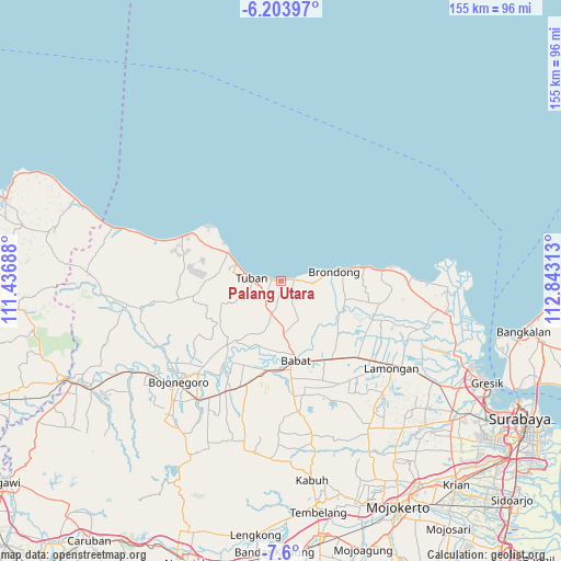
Palang Utara GPS coordinates[2]
6° 54' 9" South, 112° 8' 24" East
| Map corner | latitude | longitude |
|---|---|---|
| Upper-left | -6.20397°, | 111.43688° |
| Center: | -6.9025°, | 112.14° |
| Lower-right: | -7.6°, | 112.84313° |
| Map W x H: | 155.2×155.2 km | = 96.4×96.4mi |
| max Lat: | 5.88969° ⇑27.6% North |
| Palang Utara: | -6.9025° |
| min Lat: | ⇓72.4% South -10.934° |
| min Long | Palang Utara | max Long |
| 95.1345° | 112.14° | 140.9419° |
| W 51.1%⇐ | ⇒48.9% E |
Elevation
Elevation of Palang Utara is 6 m = 20 ft, and this is 223.7 m = 734 ft below average elevation for this country.
| Max E: |
3185 m = 10449 ft | 97.2% |
| Avg. | 229.7 m = 754 ft | |
| Palang Utara | 6 m = 20 ft | |
Min E: |
-1 m = -3 ft | 2.8% |
See also: Indonesia elevation on elevation.city.
Geographical zone
Palang Utara is located in South Torrid zone (between Equator and Tropic of Capricorn). Distance of Equator is 767.5 km =476.9 mi to North.| Distance of | km | miles | from Palang Utara |
|---|---|---|---|
| Equator | 767.5 | 476.9 | to North |
| Tropic Capricorn | 1838.4 | 1142.3 | to South |
| Antarctic Circle | 6633.7 | 4122 | to South |
| South Pole | 9239.6 | 5741.2 | to South |


Nearby cities:
15 places around Palang Utara: (largest is in red/bold)
• Banjaranyar
1.5 km =0.9 mi,  84°
84°
• Bogorejo
1.1 km =0.7 mi,  121°
121°
• Cendoro Utara
3 km =1.9 mi,  191°
191°
• Dawung
4.3 km =2.7 mi,  226°
226°
• Karang Lor
3.9 km =2.4 mi, 120°
• Karangagung Timur
3.1 km =1.9 mi, 84°
• Krandenan
2.3 km =1.4 mi,  270°
270°
• Leran Kulon
2.6 km =1.6 mi,  152°
152°
• Leran Wetan
2.8 km =1.7 mi, 145°
• Pliwetan
3.5 km =2.2 mi,  93°
93°
• Pucangkrajan
2.2 km =1.4 mi,  176°
176°
• Rembes
0.5 km =0.3 mi,  256°
256°
• Sumurgung
3.8 km =2.4 mi, 260°
• Tambakrejo
3.9 km =2.4 mi, 86°
• Wangun
4.1 km =2.5 mi,  135°
135°
Sources, notices
• [Note1] Compared only with cities in Indonesia existing in our database
• [Src1] Map data: © OpenStreetMap contributors (CC-BY-SA)
• [Src2] Other city data from geonames.org with taken over terms of usage.
• [Src3] Geographical zone / Annual Mean Temperature by Robert A. Rohde @ Wikipedia
