Kebonsari geodata
Kebonsari (East Java) is a seat of a third-order administrative division; located in Indonesia in Asia/Jakarta (GMT+7) time zone. In our database, there are 407 cities with bigger population. Compared to other cities in Indonesia, 74.9% of cities are located further ↑North; 61.7% of cities are located further ←West and 79.9% of cities have higher elevation than Kebonsari. Note1


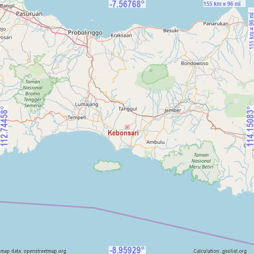
Kebonsari GPS coordinates[2]
8° 15' 50.76" South, 113° 26' 51.72" East
| Map corner | latitude | longitude |
|---|---|---|
| Upper-left | -7.56768°, | 112.74458° |
| Center: | -8.2641°, | 113.4477° |
| Lower-right: | -8.95929°, | 114.15083° |
| Map W x H: | 154.7×154.7 km | = 96.1×96.1mi |
| max Lat: | 5.88969° ⇑74.9% North |
| Kebonsari: | -8.2641° |
| min Lat: | ⇓25.1% South -10.934° |
| min Long | Kebonsari | max Long |
| 95.1345° | 113.4477° | 140.9419° |
| W 61.7%⇐ | ⇒38.3% E |
Elevation
Elevation of Kebonsari is 19 m = 62 ft, and this is 210.7 m = 691 ft below average elevation for this country.
| Max E: |
3185 m = 10449 ft | 79.9% |
| Avg. | 229.7 m = 754 ft | |
| Kebonsari | 19 m = 62 ft | |
Min E: |
-1 m = -3 ft | 20.1% |
See also: Indonesia elevation on elevation.city.
Geographical zone
Kebonsari is located in South Torrid zone (between Equator and Tropic of Capricorn). Distance of Equator is 918.9 km =571 mi to North.| Distance of | km | miles | from Kebonsari |
|---|---|---|---|
| Equator | 918.9 | 571 | to North |
| Tropic Capricorn | 1687 | 1048.3 | to South |
| Antarctic Circle | 6482.3 | 4027.9 | to South |
| South Pole | 9088.2 | 5647.1 | to South |


Nearby cities:
15 places around Kebonsari: (largest is in red/bold)
• Ampeldentokrajan
5.1 km =3.2 mi,  197°
197°
• Gadingrejo
3.5 km =2.2 mi,  335°
335°
• Gununglincingkrajan
2.1 km =1.3 mi,  295°
295°
• Karangduren Dua
5.2 km =3.2 mi,  99°
99°
• Kasiyan
6.1 km =3.8 mi,  157°
157°
• Kebonsari Kidul
1.5 km =0.9 mi, 162°
• Kedungsumurkrajan
5 km =3.1 mi,  119°
119°
• Kesambilerenkrajan
4.8 km =3 mi,  249°
249°
• Krajan Timur Mlokorejo
5 km =3.1 mi,  166°
166°
• Rejosarikrajan
2.7 km =1.7 mi,  230°
230°
• Semboropasar
6 km =3.7 mi,  357°
357°
• Sidomekar
6.1 km =3.8 mi,  13°
13°
• Sukoreno
5.5 km =3.4 mi,  289°
289°
• Umbulsari
0.6 km =0.4 mi,  325°
325°
• Wringintelu
4.2 km =2.6 mi,  128°
128°
Sources, notices
• [Note1] Compared only with cities in Indonesia existing in our database
• [Src1] Map data: © OpenStreetMap contributors (CC-BY-SA)
• [Src2] Other city data from geonames.org with taken over terms of usage.
• [Src3] Geographical zone / Annual Mean Temperature by Robert A. Rohde @ Wikipedia
