Gunungsari geodata
Gunungsari (East Java) is a seat of a fourth-order administrative division; located in Indonesia in Asia/Jakarta (GMT+7) time zone. In our database, there are 407 cities with bigger population. Compared to other cities in Indonesia, 74.8% of cities are located further ↑North; 63.1% of cities are located further ←West and 65.6% of cities have higher elevation than Gunungsari. Note1


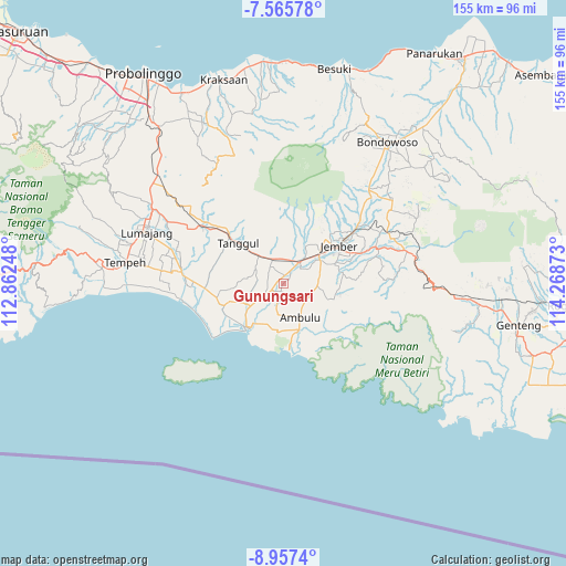
Gunungsari GPS coordinates[2]
8° 15' 43.92" South, 113° 33' 56.16" East
| Map corner | latitude | longitude |
|---|---|---|
| Upper-left | -7.56578°, | 112.86248° |
| Center: | -8.2622°, | 113.5656° |
| Lower-right: | -8.9574°, | 114.26873° |
| Map W x H: | 154.7×154.7 km | = 96.1×96.1mi |
| max Lat: | 5.88969° ⇑74.8% North |
| Gunungsari: | -8.2622° |
| min Lat: | ⇓25.2% South -10.934° |
| min Long | Gunungsari | max Long |
| 95.1345° | 113.5656° | 140.9419° |
| W 63.1%⇐ | ⇒36.9% E |
Elevation
Elevation of Gunungsari is 41 m = 135 ft, and this is 188.7 m = 619 ft below average elevation for this country.
| Max E: |
3185 m = 10449 ft | 65.6% |
| Avg. | 229.7 m = 754 ft | |
| Gunungsari | 41 m = 135 ft | |
Min E: |
-1 m = -3 ft | 34.4% |
See also: Indonesia elevation on elevation.city.
Geographical zone
Gunungsari is located in South Torrid zone (between Equator and Tropic of Capricorn). Distance of Equator is 918.7 km =570.9 mi to North.| Distance of | km | miles | from Gunungsari |
|---|---|---|---|
| Equator | 918.7 | 570.9 | to North |
| Tropic Capricorn | 1687.2 | 1048.4 | to South |
| Antarctic Circle | 6482.5 | 4028 | to South |
| South Pole | 9088.4 | 5647.3 | to South |


Nearby cities:
15 places around Gunungsari: (largest is in red/bold)
• Balung
3.2 km =2 mi,  248°
248°
• Balungkopi
4 km =2.5 mi,  219°
219°
• Bedadung Kulon
6.6 km =4.1 mi,  44°
44°
• Curahlele Wetan
2.8 km =1.7 mi,  311°
311°
• Glundengankrajan
2.3 km =1.4 mi,  205°
205°
• Gumawang
2.5 km =1.6 mi,  9°
9°
• Karangsono
6.3 km =3.9 mi, 308°
• Krajan Lor Balung Kulon
5 km =3.1 mi,  232°
232°
• Krajan Lor Gumelar
1.8 km =1.1 mi,  298°
298°
• Lohong
6.7 km =4.2 mi,  261°
261°
• Pecoro
6.6 km =4.1 mi,  25°
25°
• Petung
6.4 km =4 mi,  16°
16°
• Rowotamtu
3.8 km =2.4 mi, 26°
• Sukorejo
6 km =3.7 mi,  317°
317°
• Tutul
5.6 km =3.5 mi,  244°
244°
Sources, notices
• [Note1] Compared only with cities in Indonesia existing in our database
• [Src1] Map data: © OpenStreetMap contributors (CC-BY-SA)
• [Src2] Other city data from geonames.org with taken over terms of usage.
• [Src3] Geographical zone / Annual Mean Temperature by Robert A. Rohde @ Wikipedia
