Margo Wetan geodata
Margo Wetan (East Java) is a seat of a fourth-order administrative division; located in Indonesia in Asia/Jakarta (GMT+7) time zone. In our database, there are 407 cities with bigger population. Compared to other cities in Indonesia, 75.3% of cities are located further ↑North; 54.3% of cities are located further →East and 83% of cities have higher elevation than Margo Wetan. Note1


Margo Wetan GPS coordinates[2]
8° 16' 15.6" South, 111° 42' 39.6" East
| Map corner | latitude | longitude |
|---|---|---|
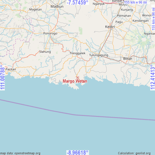
| Upper-left | -7.57459°, | 111.00788° |
| Center: | -8.271°, | 111.711° |
| Lower-right: | -8.96618°, | 112.41413° |
| Map W x H: | 154.7×154.7 km | = 96.1×96.1mi |
| max Lat: | 5.88969° ⇑75.3% North |
| Margo Wetan: | -8.271° |
| min Lat: | ⇓24.7% South -10.934° |
| min Long | Margo Wetan | max Long |
| 95.1345° | 111.711° | 140.9419° |
| W 45.7%⇐ | ⇒54.3% E |
Elevation
Elevation of Margo Wetan is 16 m = 52 ft, and this is 213.7 m = 701 ft below average elevation for this country.
| Max E: |
3185 m = 10449 ft | 83% |
| Avg. | 229.7 m = 754 ft | |
| Margo Wetan | 16 m = 52 ft | |
Min E: |
-1 m = -3 ft | 17% |
See also: Indonesia elevation on elevation.city.
Geographical zone
Margo Wetan is located in South Torrid zone (between Equator and Tropic of Capricorn). Distance of Equator is 919.6 km =571.4 mi to North.| Distance of | km | miles | from Margo Wetan |
|---|---|---|---|
| Equator | 919.6 | 571.4 | to North |
| Tropic Capricorn | 1686.3 | 1047.8 | to South |
| Antarctic Circle | 6481.5 | 4027.4 | to South |
| South Pole | 9087.4 | 5646.6 | to South |


Nearby cities:
15 places around Margo Wetan: (largest is in red/bold)
• Gading
2.8 km =1.7 mi,  213°
213°
• Gelatik
7.4 km =4.6 mi,  336°
336°
• Gemaharjo
3.7 km =2.3 mi,  348°
348°
• Jajar
9.4 km =5.8 mi,  254°
254°
• Keboireng
9.2 km =5.7 mi,  44°
44°
• Ketawang
1.9 km =1.2 mi,  123°
123°
• Krajan Sawahan
1.7 km =1.1 mi,  307°
307°
• Ngembel
9 km =5.6 mi, 351°
• Nglampir
9.2 km =5.7 mi,  15°
15°
• Ponggok
4.6 km =2.9 mi,  323°
323°
• Prigi
0.5 km =0.3 mi,  105°
105°
• Sebo
3.2 km =2 mi, 345°
• Sedayugunung
8.3 km =5.2 mi,  28°
28°
• Watuagung
8.3 km =5.2 mi,  3°
3°
• Watulimo
5.6 km =3.5 mi,  5°
5°
Sources, notices
• [Note1] Compared only with cities in Indonesia existing in our database
• [Src1] Map data: © OpenStreetMap contributors (CC-BY-SA)
• [Src2] Other city data from geonames.org with taken over terms of usage.
• [Src3] Geographical zone / Annual Mean Temperature by Robert A. Rohde @ Wikipedia
