Bolorejo geodata
Bolorejo (East Java) is a seat of a fourth-order administrative division; located in Indonesia in Asia/Jakarta (GMT+7) time zone. In our database, there are 407 cities with bigger population. Compared to other cities in Indonesia, 63.5% of cities are located further ↑North; 52% of cities are located further →East and 51.7% of cities have higher elevation than Bolorejo. Note1


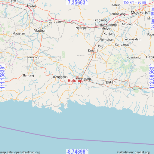
Bolorejo GPS coordinates[2]
8° 3' 12.24" South, 111° 51' 45" East
| Map corner | latitude | longitude |
|---|---|---|
| Upper-left | -7.35663°, | 111.15938° |
| Center: | -8.0534°, | 111.8625° |
| Lower-right: | -8.74898°, | 112.56563° |
| Map W x H: | 154.8×154.8 km | = 96.2×96.2mi |
| max Lat: | 5.88969° ⇑63.5% North |
| Bolorejo: | -8.0534° |
| min Lat: | ⇓36.5% South -10.934° |
| min Long | Bolorejo | max Long |
| 95.1345° | 111.8625° | 140.9419° |
| W 48%⇐ | ⇒52% E |
Elevation
Elevation of Bolorejo is 96 m = 315 ft, and this is 133.7 m = 439 ft below average elevation for this country.
| Max E: |
3185 m = 10449 ft | 51.7% |
| Avg. | 229.7 m = 754 ft | |
| Bolorejo | 96 m = 315 ft | |
Min E: |
-1 m = -3 ft | 48.3% |
See also: Indonesia elevation on elevation.city.
Geographical zone
Bolorejo is located in South Torrid zone (between Equator and Tropic of Capricorn). Distance of Equator is 895.5 km =556.4 mi to North.| Distance of | km | miles | from Bolorejo |
|---|---|---|---|
| Equator | 895.5 | 556.4 | to North |
| Tropic Capricorn | 1710.5 | 1062.9 | to South |
| Antarctic Circle | 6505.7 | 4042.5 | to South |
| South Pole | 9111.6 | 5661.7 | to South |


Nearby cities:
15 places around Bolorejo: (largest is in red/bold)
• Banaran
2.3 km =1.4 mi,  9°
9°
• Batangsaren
2 km =1.2 mi,  91°
91°
• Bebekan
1.4 km =0.9 mi,  127°
127°
• Bendo
2.3 km =1.4 mi,  168°
168°
• Boneng
0.8 km =0.5 mi,  46°
46°
• Irongganan
1 km =0.6 mi,  72°
72°
• Jabon
2.4 km =1.5 mi,  29°
29°
• Jarakan
1.4 km =0.9 mi,  237°
237°
• Kalangbret
0.3 km =0.2 mi,  75°
75°
• Kleben
2.5 km =1.6 mi,  277°
277°
• Mojasari
0.8 km =0.5 mi,  355°
355°
• Ngrendeng
2.2 km =1.4 mi,  222°
222°
• Pucangan
2.4 km =1.5 mi,  312°
312°
• Srabah
2.1 km =1.3 mi,  317°
317°
• Wonokromo
1.5 km =0.9 mi,  256°
256°
Sources, notices
• [Note1] Compared only with cities in Indonesia existing in our database
• [Src1] Map data: © OpenStreetMap contributors (CC-BY-SA)
• [Src2] Other city data from geonames.org with taken over terms of usage.
• [Src3] Geographical zone / Annual Mean Temperature by Robert A. Rohde @ Wikipedia
