Tandes geodata
Tandes (East Java) is a seat of a fourth-order administrative division; located in Indonesia in Asia/Jakarta (GMT+7) time zone. In our database, there are 407 cities with bigger population. Compared to other cities in Indonesia, 57.2% of cities are located further ↓South; 62.8% of cities are located further ←West and 90.6% of cities have higher elevation than Tandes. Note1


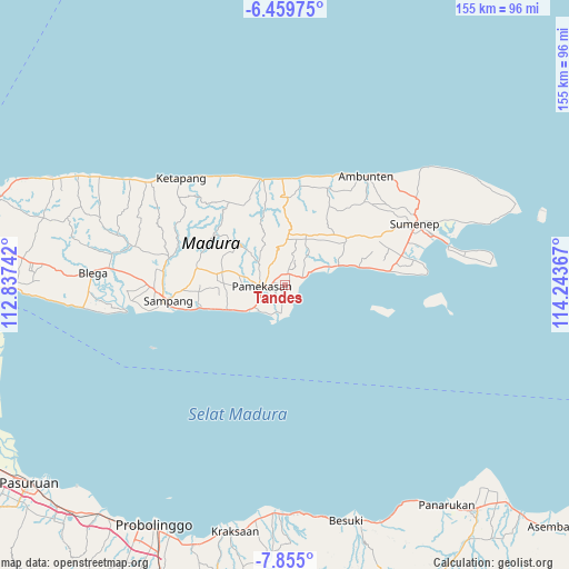
Tandes GPS coordinates[2]
7° 9' 28.476" South, 113° 32' 25.944" East
| Map corner | latitude | longitude |
|---|---|---|
| Upper-left | -6.45975°, | 112.83742° |
| Center: | -7.15791°, | 113.54054° |
| Lower-right: | -7.855°, | 114.24367° |
| Map W x H: | 155.1×155.1 km | = 96.4×96.4mi |
| max Lat: | 5.88969° ⇑42.8% North |
| Tandes: | -7.15791° |
| min Lat: | ⇓57.2% South -10.934° |
| min Long | Tandes | max Long |
| 95.1345° | 113.54054° | 140.9419° |
| W 62.8%⇐ | ⇒37.2% E |
Elevation
Elevation of Tandes is 10 m = 33 ft, and this is 219.7 m = 721 ft below average elevation for this country.
| Max E: |
3185 m = 10449 ft | 90.6% |
| Avg. | 229.7 m = 754 ft | |
| Tandes | 10 m = 33 ft | |
Min E: |
-1 m = -3 ft | 9.4% |
See also: Indonesia elevation on elevation.city.
Geographical zone
Tandes is located in South Torrid zone (between Equator and Tropic of Capricorn). Distance of Equator is 795.9 km =494.5 mi to North.| Distance of | km | miles | from Tandes |
|---|---|---|---|
| Equator | 795.9 | 494.5 | to North |
| Tropic Capricorn | 1810 | 1124.7 | to South |
| Antarctic Circle | 6605.3 | 4104.3 | to South |
| South Pole | 9211.2 | 5723.6 | to South |


Nearby cities:
15 places around Tandes: (largest is in red/bold)
• Barajalan
2.8 km =1.7 mi,  346°
346°
• Biris Daja
2.3 km =1.4 mi,  281°
281°
• Bulay
1.9 km =1.2 mi,  27°
27°
• Bunder
3.4 km =2.1 mi,  200°
200°
• Galis
1.5 km =0.9 mi,  82°
82°
• Grujugan
3.3 km =2.1 mi,  355°
355°
• Larangan
3.3 km =2.1 mi,  12°
12°
• Lembung Tengah
2.4 km =1.5 mi,  101°
101°
• Lobuk
2.4 km =1.5 mi,  266°
266°
• Nampera
1.6 km =1 mi,  91°
91°
• Plasah
2.4 km =1.5 mi,  142°
142°
• Polagan Tengah
3.1 km =1.9 mi,  45°
45°
• Rongrongan
1.6 km =1 mi,  301°
301°
• Tentenan
3.2 km =2 mi, 345°
• Toampar
3 km =1.9 mi,  4°
4°
Sources, notices
• [Note1] Compared only with cities in Indonesia existing in our database
• [Src1] Map data: © OpenStreetMap contributors (CC-BY-SA)
• [Src2] Other city data from geonames.org with taken over terms of usage.
• [Src3] Geographical zone / Annual Mean Temperature by Robert A. Rohde @ Wikipedia
