Pakel geodata
Pakel (East Java) is a seat of a third-order administrative division; located in Indonesia in Asia/Jakarta (GMT+7) time zone. In our database, there are 407 cities with bigger population. Compared to other cities in Indonesia, 61.3% of cities are located further ↑North; 51.3% of cities are located further →East and 54% of cities have higher elevation than Pakel. Note1


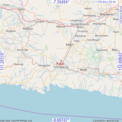
Pakel GPS coordinates[2]
8° 0' 6.48" South, 111° 54' 22.68" East
| Map corner | latitude | longitude |
|---|---|---|
| Upper-left | -7.30494°, | 111.20318° |
| Center: | -8.0018°, | 111.9063° |
| Lower-right: | -8.69747°, | 112.60943° |
| Map W x H: | 154.8×154.8 km | = 96.2×96.2mi |
| max Lat: | 5.88969° ⇑61.3% North |
| Pakel: | -8.0018° |
| min Lat: | ⇓38.7% South -10.934° |
| min Long | Pakel | max Long |
| 95.1345° | 111.9063° | 140.9419° |
| W 48.7%⇐ | ⇒51.3% E |
Elevation
Elevation of Pakel is 89 m = 292 ft, and this is 140.7 m = 462 ft below average elevation for this country.
| Max E: |
3185 m = 10449 ft | 54% |
| Avg. | 229.7 m = 754 ft | |
| Pakel | 89 m = 292 ft | |
Min E: |
-1 m = -3 ft | 46% |
See also: Indonesia elevation on elevation.city.
Geographical zone
Pakel is located in South Torrid zone (between Equator and Tropic of Capricorn). Distance of Equator is 889.7 km =552.8 mi to North.| Distance of | km | miles | from Pakel |
|---|---|---|---|
| Equator | 889.7 | 552.8 | to North |
| Tropic Capricorn | 1716.2 | 1066.4 | to South |
| Antarctic Circle | 6511.5 | 4046.1 | to South |
| South Pole | 9117.3 | 5665.2 | to South |


Nearby cities:
15 places around Pakel: (largest is in red/bold)
• Bungur
3.4 km =2.1 mi,  214°
214°
• Gendingsari
3 km =1.9 mi,  173°
173°
• Karangrejo
0.3 km =0.2 mi,  112°
112°
• Majan
4.2 km =2.6 mi,  185°
185°
• Ngantru
2.3 km =1.4 mi, 113°
• Ngasinan
3 km =1.9 mi, 111°
• Pulerejo
3.8 km =2.4 mi,  91°
91°
• Sembon
1.4 km =0.9 mi,  199°
199°
• Setonobendo
3.2 km =2 mi,  234°
234°
• Simo Satu
3.9 km =2.4 mi, 185°
• Sukowidodo Barat
2 km =1.2 mi,  237°
237°
• Tamanan
2.8 km =1.7 mi, 210°
• Tapan
4.4 km =2.7 mi,  142°
142°
• Tebokan
0.9 km =0.6 mi,  117°
117°
• Tiang
2 km =1.2 mi,  270°
270°
Sources, notices
• [Note1] Compared only with cities in Indonesia existing in our database
• [Src1] Map data: © OpenStreetMap contributors (CC-BY-SA)
• [Src2] Other city data from geonames.org with taken over terms of usage.
• [Src3] Geographical zone / Annual Mean Temperature by Robert A. Rohde @ Wikipedia
