Setonobendo geodata
Setonobendo (East Java) is a seat of a fourth-order administrative division; located in Indonesia in Asia/Jakarta (GMT+7) time zone. In our database, there are 407 cities with bigger population. Compared to other cities in Indonesia, 62% of cities are located further ↑North; 51.8% of cities are located further →East and 51.4% of cities have higher elevation than Setonobendo. Note1


Setonobendo GPS coordinates[2]
8° 1' 6.96" South, 111° 52' 58.44" East
| Map corner | latitude | longitude |
|---|---|---|
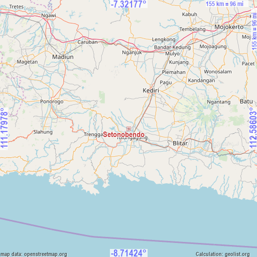
| Upper-left | -7.32177°, | 111.17978° |
| Center: | -8.0186°, | 111.8829° |
| Lower-right: | -8.71424°, | 112.58603° |
| Map W x H: | 154.8×154.8 km | = 96.2×96.2mi |
| max Lat: | 5.88969° ⇑62% North |
| Setonobendo: | -8.0186° |
| min Lat: | ⇓38% South -10.934° |
| min Long | Setonobendo | max Long |
| 95.1345° | 111.8829° | 140.9419° |
| W 48.2%⇐ | ⇒51.8% E |
Elevation
Elevation of Setonobendo is 97 m = 318 ft, and this is 132.7 m = 435 ft below average elevation for this country.
| Max E: |
3185 m = 10449 ft | 51.4% |
| Avg. | 229.7 m = 754 ft | |
| Setonobendo | 97 m = 318 ft | |
Min E: |
-1 m = -3 ft | 48.6% |
See also: Indonesia elevation on elevation.city.
Geographical zone
Setonobendo is located in South Torrid zone (between Equator and Tropic of Capricorn). Distance of Equator is 891.6 km =554 mi to North.| Distance of | km | miles | from Setonobendo |
|---|---|---|---|
| Equator | 891.6 | 554 | to North |
| Tropic Capricorn | 1714.3 | 1065.2 | to South |
| Antarctic Circle | 6509.6 | 4044.9 | to South |
| South Pole | 9115.5 | 5664.1 | to South |


Nearby cities:
15 places around Setonobendo: (largest is in red/bold)
• Banaran
2.5 km =1.6 mi,  228°
228°
• Bungur
1.1 km =0.7 mi,  145°
145°
• Gendingsari
3.1 km =1.9 mi,  110°
110°
• Jabon
2.1 km =1.3 mi,  211°
211°
• Karangrejo
3.4 km =2.1 mi,  59°
59°
• Majan
3.1 km =1.9 mi,  136°
136°
• Pakel
3.2 km =2 mi,  54°
54°
• Sembon
2.2 km =1.4 mi,  75°
75°
• Sendung
2.6 km =1.6 mi,  248°
248°
• Simo Satu
3 km =1.9 mi,  132°
132°
• Sukowidodo Barat
1.2 km =0.7 mi, 48°
• Tamanan
1.3 km =0.8 mi,  115°
115°
• Tebokan
3.7 km =2.3 mi,  66°
66°
• Tiang
2 km =1.2 mi,  17°
17°
• Winong
3.4 km =2.1 mi, 145°
Sources, notices
• [Note1] Compared only with cities in Indonesia existing in our database
• [Src1] Map data: © OpenStreetMap contributors (CC-BY-SA)
• [Src2] Other city data from geonames.org with taken over terms of usage.
• [Src3] Geographical zone / Annual Mean Temperature by Robert A. Rohde @ Wikipedia
