Kahabe geodata
Kahabe (East Nusa Tenggara) is a seat of a fourth-order administrative division; located in Indonesia in Asia/Makassar (GMT+8) time zone. In our database, there are 407 cities with bigger population. Compared to other cities in Indonesia, 99% of cities are located further ↑North; 87.8% of cities are located further ←West and 92.1% of cities have higher elevation than Kahabe. Note1


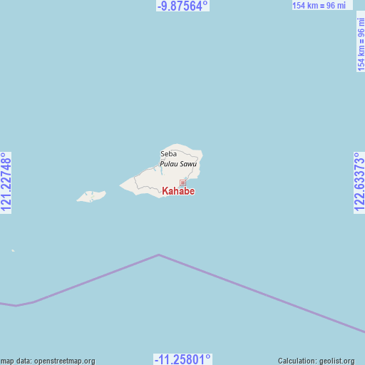
Kahabe GPS coordinates[2]
10° 34' 3.36" South, 121° 55' 50.16" East
| Map corner | latitude | longitude |
|---|---|---|
| Upper-left | -9.87564°, | 121.22748° |
| Center: | -10.5676°, | 121.9306° |
| Lower-right: | -11.25801°, | 122.63373° |
| Map W x H: | 153.7×153.7 km | = 95.5×95.5mi |
| max Lat: | 5.88969° ⇑99% North |
| Kahabe: | -10.5676° |
| min Lat: | ⇓1% South -10.934° |
| min Long | Kahabe | max Long |
| 95.1345° | 121.9306° | 140.9419° |
| W 87.8%⇐ | ⇒12.2% E |
Elevation
Elevation of Kahabe is 9 m = 30 ft, and this is 220.7 m = 724 ft below average elevation for this country.
| Max E: |
3185 m = 10449 ft | 92.1% |
| Avg. | 229.7 m = 754 ft | |
| Kahabe | 9 m = 30 ft | |
Min E: |
-1 m = -3 ft | 7.9% |
See also: Indonesia elevation on elevation.city.
Geographical zone
Kahabe is located in South Torrid zone (between Equator and Tropic of Capricorn). Distance of Equator is 1175 km =730.1 mi to North.| Distance of | km | miles | from Kahabe |
|---|---|---|---|
| Equator | 1175 | 730.1 | to North |
| Tropic Capricorn | 1430.9 | 889.1 | to South |
| Antarctic Circle | 6226.2 | 3868.8 | to South |
| South Pole | 8832.1 | 5488 | to South |


Nearby cities:
15 places around Kahabe: (largest is in red/bold)
• Bolou
9 km =5.6 mi,  31°
31°
• Daikela
3.5 km =2.2 mi,  268°
268°
• Dairiti
9.1 km =5.7 mi,  290°
290°
• Dinititi
10.6 km =6.6 mi,  305°
305°
• Duku
8.1 km =5 mi,  246°
246°
• Eilau
3.3 km =2.1 mi,  42°
42°
• Guluhawu
9.5 km =5.9 mi, 31°
• Jarada
5.2 km =3.2 mi,  12°
12°
• Loboma
6.4 km =4 mi, 37°
• Lokorae
5 km =3.1 mi,  327°
327°
• Padadue
7.7 km =4.8 mi,  3°
3°
• Parajara
5.6 km =3.5 mi,  234°
234°
• Raemude
9.2 km =5.7 mi,  280°
280°
• Unukume
8.9 km =5.5 mi, 35°
• Waduwala
9 km =5.6 mi, 234°
Sources, notices
• [Note1] Compared only with cities in Indonesia existing in our database
• [Src1] Map data: © OpenStreetMap contributors (CC-BY-SA)
• [Src2] Other city data from geonames.org with taken over terms of usage.
• [Src3] Geographical zone / Annual Mean Temperature by Robert A. Rohde @ Wikipedia
