Talambung Laok geodata
Talambung Laok (East Java) is a seat of a fourth-order administrative division; located in Indonesia in Asia/Jakarta (GMT+7) time zone. In our database, there are 407 cities with bigger population. Compared to other cities in Indonesia, 63.4% of cities are located further ↓South; 64.4% of cities are located further ←West and 54% of cities have higher elevation than Talambung Laok. Note1


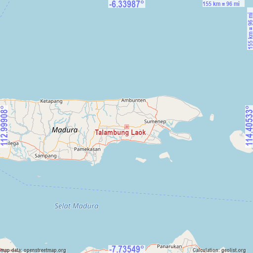
Talambung Laok GPS coordinates[2]
7° 2' 17.52" South, 113° 42' 7.92" East
| Map corner | latitude | longitude |
|---|---|---|
| Upper-left | -6.33987°, | 112.99908° |
| Center: | -7.0382°, | 113.7022° |
| Lower-right: | -7.73549°, | 114.40533° |
| Map W x H: | 155.2×155.2 km | = 96.4×96.4mi |
| max Lat: | 5.88969° ⇑36.6% North |
| Talambung Laok: | -7.0382° |
| min Lat: | ⇓63.4% South -10.934° |
| min Long | Talambung Laok | max Long |
| 95.1345° | 113.7022° | 140.9419° |
| W 64.4%⇐ | ⇒35.6% E |
Elevation
Elevation of Talambung Laok is 89 m = 292 ft, and this is 140.7 m = 462 ft below average elevation for this country.
| Max E: |
3185 m = 10449 ft | 54% |
| Avg. | 229.7 m = 754 ft | |
| Talambung Laok | 89 m = 292 ft | |
Min E: |
-1 m = -3 ft | 46% |
See also: Indonesia elevation on elevation.city.
Geographical zone
Talambung Laok is located in South Torrid zone (between Equator and Tropic of Capricorn). Distance of Equator is 782.6 km =486.3 mi to North.| Distance of | km | miles | from Talambung Laok |
|---|---|---|---|
| Equator | 782.6 | 486.3 | to North |
| Tropic Capricorn | 1823.3 | 1132.9 | to South |
| Antarctic Circle | 6618.6 | 4112.6 | to South |
| South Pole | 9224.5 | 5731.8 | to South |


Nearby cities:
15 places around Talambung Laok: (largest is in red/bold)
• Dajalorong
2.8 km =1.7 mi,  153°
153°
• Dajasongai
3.6 km =2.2 mi,  101°
101°
• Duko
1.9 km =1.2 mi,  230°
230°
• Ganding
1.5 km =0.9 mi,  267°
267°
• Gulukguluk
3.5 km =2.2 mi,  238°
238°
• Karangjati
2.7 km =1.7 mi,  125°
125°
• Kebunan
1.9 km =1.2 mi,  159°
159°
• Konkokon
1.9 km =1.2 mi,  277°
277°
• Loaksongai
3.1 km =1.9 mi,  116°
116°
• Mangar
3.2 km =2 mi,  35°
35°
• Masjid
1.8 km =1.1 mi,  259°
259°
• Naga
1.2 km =0.7 mi, 235°
• Panggungdaja
1.9 km =1.2 mi,  211°
211°
• Sumberkindagan
3.1 km =1.9 mi, 209°
• Timurleke
2.8 km =1.7 mi, 272°
Sources, notices
• [Note1] Compared only with cities in Indonesia existing in our database
• [Src1] Map data: © OpenStreetMap contributors (CC-BY-SA)
• [Src2] Other city data from geonames.org with taken over terms of usage.
• [Src3] Geographical zone / Annual Mean Temperature by Robert A. Rohde @ Wikipedia
