Torserajah geodata
Torserajah (East Java) is a seat of a fourth-order administrative division; located in Indonesia in Asia/Jakarta (GMT+7) time zone. In our database, there are 407 cities with bigger population. Compared to other cities in Indonesia, 67.6% of cities are located further ↓South; 58.5% of cities are located further ←West and 64.5% of cities have higher elevation than Torserajah. Note1


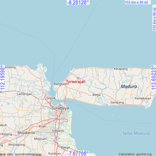
Torserajah GPS coordinates[2]
6° 58' 46.92" South, 112° 53' 56.76" East
| Map corner | latitude | longitude |
|---|---|---|
| Upper-left | -6.28128°, | 112.19598° |
| Center: | -6.9797°, | 112.8991° |
| Lower-right: | -7.67708°, | 113.60223° |
| Map W x H: | 155.2×155.2 km | = 96.4×96.4mi |
| max Lat: | 5.88969° ⇑32.4% North |
| Torserajah: | -6.9797° |
| min Lat: | ⇓67.6% South -10.934° |
| min Long | Torserajah | max Long |
| 95.1345° | 112.8991° | 140.9419° |
| W 58.5%⇐ | ⇒41.5% E |
Elevation
Elevation of Torserajah is 44 m = 144 ft, and this is 185.7 m = 609 ft below average elevation for this country.
| Max E: |
3185 m = 10449 ft | 64.5% |
| Avg. | 229.7 m = 754 ft | |
| Torserajah | 44 m = 144 ft | |
Min E: |
-1 m = -3 ft | 35.5% |
See also: Indonesia elevation on elevation.city.
Geographical zone
Torserajah is located in South Torrid zone (between Equator and Tropic of Capricorn). Distance of Equator is 776.1 km =482.2 mi to North.| Distance of | km | miles | from Torserajah |
|---|---|---|---|
| Equator | 776.1 | 482.2 | to North |
| Tropic Capricorn | 1829.8 | 1137 | to South |
| Antarctic Circle | 6625.1 | 4116.6 | to South |
| South Pole | 9231 | 5735.9 | to South |


Nearby cities:
15 places around Torserajah: (largest is in red/bold)
• Basen
3.3 km =2.1 mi,  309°
309°
• Berbeluk Timur
4.3 km =2.7 mi,  296°
296°
• Bragang Tengah
5 km =3.1 mi,  8°
8°
• Campor
1.7 km =1.1 mi, 296°
• Cendagah
5.7 km =3.5 mi, 296°
• Doroagung
3.1 km =1.9 mi, 305°
• Karangduwak
5.7 km =3.5 mi,  271°
271°
• Koronganayam
4.6 km =2.9 mi,  88°
88°
• Mangkon Daja
5.6 km =3.5 mi,  292°
292°
• Mursaba
4.5 km =2.8 mi,  281°
281°
• Nakajah
4 km =2.5 mi,  19°
19°
• Palenggihan
3.7 km =2.3 mi,  58°
58°
• Polongan Daja
5.7 km =3.5 mi,  319°
319°
• Tambeggan Satu
5.7 km =3.5 mi, 299°
• Terbuh
2.6 km =1.6 mi, 16°
Sources, notices
• [Note1] Compared only with cities in Indonesia existing in our database
• [Src1] Map data: © OpenStreetMap contributors (CC-BY-SA)
• [Src2] Other city data from geonames.org with taken over terms of usage.
• [Src3] Geographical zone / Annual Mean Temperature by Robert A. Rohde @ Wikipedia
