Campor geodata
Campor (East Java) is a seat of a third-order administrative division; located in Indonesia in Asia/Jakarta (GMT+7) time zone. In our database, there are 407 cities with bigger population. Compared to other cities in Indonesia, 68.1% of cities are located further ↓South; 58.4% of cities are located further ←West and 75.5% of cities have higher elevation than Campor. Note1


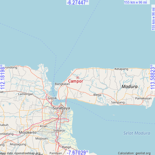
Campor GPS coordinates[2]
6° 58' 22.44" South, 112° 53' 6.36" East
| Map corner | latitude | longitude |
|---|---|---|
| Upper-left | -6.27447°, | 112.18198° |
| Center: | -6.9729°, | 112.8851° |
| Lower-right: | -7.67029°, | 113.58823° |
| Map W x H: | 155.2×155.2 km | = 96.4×96.4mi |
| max Lat: | 5.88969° ⇑31.9% North |
| Campor: | -6.9729° |
| min Lat: | ⇓68.1% South -10.934° |
| min Long | Campor | max Long |
| 95.1345° | 112.8851° | 140.9419° |
| W 58.4%⇐ | ⇒41.6% E |
Elevation
Elevation of Campor is 24 m = 79 ft, and this is 205.7 m = 675 ft below average elevation for this country.
| Max E: |
3185 m = 10449 ft | 75.5% |
| Avg. | 229.7 m = 754 ft | |
| Campor | 24 m = 79 ft | |
Min E: |
-1 m = -3 ft | 24.5% |
See also: Indonesia elevation on elevation.city.
Geographical zone
Campor is located in South Torrid zone (between Equator and Tropic of Capricorn). Distance of Equator is 775.3 km =481.7 mi to North.| Distance of | km | miles | from Campor |
|---|---|---|---|
| Equator | 775.3 | 481.7 | to North |
| Tropic Capricorn | 1830.6 | 1137.5 | to South |
| Antarctic Circle | 6625.9 | 4117.1 | to South |
| South Pole | 9231.7 | 5736.3 | to South |


Nearby cities:
15 places around Campor: (largest is in red/bold)
• Basen
1.7 km =1.1 mi,  323°
323°
• Berbeluk Timur
2.6 km =1.6 mi,  296°
296°
• Cendagah
3.9 km =2.4 mi, 296°
• Dlemer
4.4 km =2.7 mi,  285°
285°
• Doroagung
1.4 km =0.9 mi, 316°
• Karangduwak
4.2 km =2.6 mi,  261°
261°
• Karangpao
4.3 km =2.7 mi, 298°
• Makan
4.1 km =2.5 mi,  311°
311°
• Mangkon Daja
3.9 km =2.4 mi, 291°
• Mursaba
2.9 km =1.8 mi,  272°
272°
• Nakajah
4.2 km =2.6 mi,  43°
43°
• Polongan Daja
4.2 km =2.6 mi,  328°
328°
• Tambeggan Satu
4 km =2.5 mi, 301°
• Terbuh
2.8 km =1.7 mi,  53°
53°
• Torserajah
1.7 km =1.1 mi,  116°
116°
Sources, notices
• [Note1] Compared only with cities in Indonesia existing in our database
• [Src1] Map data: © OpenStreetMap contributors (CC-BY-SA)
• [Src2] Other city data from geonames.org with taken over terms of usage.
• [Src3] Geographical zone / Annual Mean Temperature by Robert A. Rohde @ Wikipedia
