Kampungbaru geodata
Kampungbaru (East Nusa Tenggara) is a seat of a fourth-order administrative division; located in Indonesia in Asia/Makassar (GMT+8) time zone. In our database, there are 407 cities with bigger population. Compared to other cities in Indonesia, 96.3% of cities are located further ↑North; 93.2% of cities are located further ←West and 81.9% of cities have higher elevation than Kampungbaru. Note1


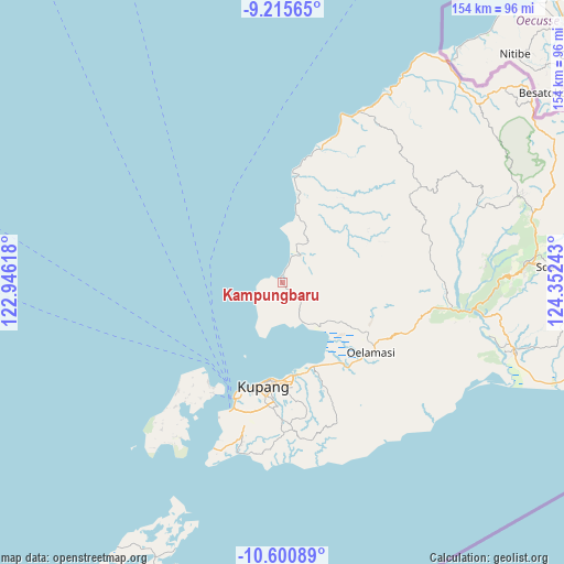
Kampungbaru GPS coordinates[2]
9° 54' 32.4" South, 123° 38' 57.48" East
| Map corner | latitude | longitude |
|---|---|---|
| Upper-left | -9.21565°, | 122.94618° |
| Center: | -9.909°, | 123.6493° |
| Lower-right: | -10.60089°, | 124.35243° |
| Map W x H: | 154×154 km | = 95.7×95.7mi |
| max Lat: | 5.88969° ⇑96.3% North |
| Kampungbaru: | -9.909° |
| min Lat: | ⇓3.7% South -10.934° |
| min Long | Kampungbaru | max Long |
| 95.1345° | 123.6493° | 140.9419° |
| W 93.2%⇐ | ⇒6.8% E |
Elevation
Elevation of Kampungbaru is 17 m = 56 ft, and this is 212.7 m = 698 ft below average elevation for this country.
| Max E: |
3185 m = 10449 ft | 81.9% |
| Avg. | 229.7 m = 754 ft | |
| Kampungbaru | 17 m = 56 ft | |
Min E: |
-1 m = -3 ft | 18.1% |
See also: Indonesia elevation on elevation.city.
Geographical zone
Kampungbaru is located in South Torrid zone (between Equator and Tropic of Capricorn). Distance of Equator is 1101.8 km =684.6 mi to North.| Distance of | km | miles | from Kampungbaru |
|---|---|---|---|
| Equator | 1101.8 | 684.6 | to North |
| Tropic Capricorn | 1504.1 | 934.6 | to South |
| Antarctic Circle | 6299.4 | 3914.3 | to South |
| South Pole | 8905.3 | 5533.5 | to South |


Nearby cities:
15 places around Kampungbaru: (largest is in red/bold)
• Babau
26.5 km =16.5 mi,  145°
145°
• Bipolo
22.5 km =14 mi,  122°
122°
• Kiuteta
25.2 km =15.7 mi,  164°
164°
• Lasiana
25.5 km =15.8 mi,  175°
175°
• Merdeka
26.2 km =16.3 mi, 147°
• Naifalo
25.6 km =15.9 mi,  106°
106°
• Nunkurus
25.9 km =16.1 mi,  131°
131°
• Oebelo
25.1 km =15.6 mi, 152°
• Oelbiteno
21.3 km =13.2 mi,  94°
94°
• Oeteta
16.4 km =10.2 mi, 134°
• Pariti
15.7 km =9.8 mi,  138°
138°
• Pitai
11.3 km =7 mi, 182°
• Siumate
8.9 km =5.5 mi,  32°
32°
• Tarus
25.2 km =15.7 mi,  170°
170°
• Tuapukan
26.1 km =16.2 mi, 148°
Sources, notices
• [Note1] Compared only with cities in Indonesia existing in our database
• [Src1] Map data: © OpenStreetMap contributors (CC-BY-SA)
• [Src2] Other city data from geonames.org with taken over terms of usage.
• [Src3] Geographical zone / Annual Mean Temperature by Robert A. Rohde @ Wikipedia
