Oenaek geodata
Oenaek (East Nusa Tenggara) is a seat of a fourth-order administrative division; located in Indonesia in Asia/Makassar (GMT+8) time zone. In our database, there are 407 cities with bigger population. Compared to other cities in Indonesia, 97% of cities are located further ↑North; 94.2% of cities are located further ←West and 64.2% of cities have lower elevation than Oenaek. Note1


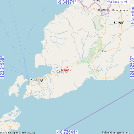
Oenaek GPS coordinates[2]
10° 2' 5.28" South, 123° 55' 22.08" East
| Map corner | latitude | longitude |
|---|---|---|
| Upper-left | -9.34171°, | 123.21968° |
| Center: | -10.0348°, | 123.9228° |
| Lower-right: | -10.72641°, | 124.62593° |
| Map W x H: | 154×154 km | = 95.7×95.7mi |
| max Lat: | 5.88969° ⇑97% North |
| Oenaek: | -10.0348° |
| min Lat: | ⇓3% South -10.934° |
| min Long | Oenaek | max Long |
| 95.1345° | 123.9228° | 140.9419° |
| W 94.2%⇐ | ⇒5.8% E |
Elevation
Elevation of Oenaek is 211 m = 692 ft, and this is 18.7 m = 61 ft below average elevation for this country.
| Max E: |
3185 m = 10449 ft | 35.8% |
| Avg. | 229.7 m = 754 ft | |
| Oenaek | 211 m = 692 ft | |
Min E: |
-1 m = -3 ft | 64.2% |
See also: Indonesia elevation on elevation.city.
Geographical zone
Oenaek is located in South Torrid zone (between Equator and Tropic of Capricorn). Distance of Equator is 1115.8 km =693.3 mi to North.| Distance of | km | miles | from Oenaek |
|---|---|---|---|
| Equator | 1115.8 | 693.3 | to North |
| Tropic Capricorn | 1490.2 | 926 | to South |
| Antarctic Circle | 6285.4 | 3905.6 | to South |
| South Pole | 8891.3 | 5524.8 | to South |


Nearby cities:
15 places around Oenaek: (largest is in red/bold)
• Bipolo
11.2 km =7 mi,  278°
278°
• Camplong
0.3 km =0.2 mi,  168°
168°
• Ekateta
7.6 km =4.7 mi,  21°
21°
• Kairane
13.6 km =8.5 mi, 170°
• Kiukasen
11.1 km =6.9 mi,  189°
189°
• Kusbese
12.9 km =8 mi,  41°
41°
• Naibonat
13.1 km =8.1 mi,  234°
234°
• Naifalo
8.5 km =5.3 mi,  320°
320°
• Naikolan
1.9 km =1.2 mi, 186°
• Nis’oni
14.4 km =8.9 mi,  215°
215°
• Nunkurus
11 km =6.8 mi,  253°
253°
• Oelamasi
5.8 km =3.6 mi,  235°
235°
• Oelbiteno
15 km =9.3 mi, 324°
• Pukdale
13.7 km =8.5 mi, 226°
• Tunmunih
6.8 km =4.2 mi,  101°
101°
Sources, notices
• [Note1] Compared only with cities in Indonesia existing in our database
• [Src1] Map data: © OpenStreetMap contributors (CC-BY-SA)
• [Src2] Other city data from geonames.org with taken over terms of usage.
• [Src3] Geographical zone / Annual Mean Temperature by Robert A. Rohde @ Wikipedia
