Kusbese geodata
Kusbese (East Nusa Tenggara) is a seat of a fourth-order administrative division; located in Indonesia in Asia/Makassar (GMT+8) time zone. In our database, there are 407 cities with bigger population. Compared to other cities in Indonesia, 96.6% of cities are located further ↑North; 94.4% of cities are located further ←West and 69% of cities have lower elevation than Kusbese. Note1


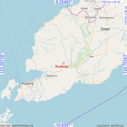
Kusbese GPS coordinates[2]
9° 56' 52.44" South, 124° 0' 1.8" East
| Map corner | latitude | longitude |
|---|---|---|
| Upper-left | -9.25463°, | 123.29738° |
| Center: | -9.9479°, | 124.0005° |
| Lower-right: | -10.6397°, | 124.70363° |
| Map W x H: | 154×154 km | = 95.7×95.7mi |
| max Lat: | 5.88969° ⇑96.6% North |
| Kusbese: | -9.9479° |
| min Lat: | ⇓3.4% South -10.934° |
| min Long | Kusbese | max Long |
| 95.1345° | 124.0005° | 140.9419° |
| W 94.4%⇐ | ⇒5.6% E |
Elevation
Elevation of Kusbese is 280 m = 919 ft, and this is 50.3 m = 165 ft above average elevation for this country.
| Max E: |
3185 m = 10449 ft | 31% |
| Kusbese | 280 m 919 ft | |
| Avg. | 229.7 m = 754 ft | |
Min E: |
-1 m = -3 ft | 69% |
See also: Indonesia elevation on elevation.city.
Geographical zone
Kusbese is located in South Torrid zone (between Equator and Tropic of Capricorn). Distance of Equator is 1106.1 km =687.3 mi to North.| Distance of | km | miles | from Kusbese |
|---|---|---|---|
| Equator | 1106.1 | 687.3 | to North |
| Tropic Capricorn | 1499.8 | 931.9 | to South |
| Antarctic Circle | 6295.1 | 3911.6 | to South |
| South Pole | 8901 | 5530.8 | to South |


Nearby cities:
15 places around Kusbese: (largest is in red/bold)
• Bokong Timur
7.2 km =4.5 mi,  112°
112°
• Bonak
12.9 km =8 mi,  297°
297°
• Camplong
13.1 km =8.1 mi,  220°
220°
• Ekateta
6.3 km =3.9 mi,  246°
246°
• Hueknutu
10.3 km =6.4 mi,  12°
12°
• Koa
10 km =6.2 mi,  79°
79°
• Kuafeu
13.7 km =8.5 mi,  93°
93°
• Meobesi
11.5 km =7.1 mi,  350°
350°
• Naifalo
14.3 km =8.9 mi,  257°
257°
• Naikolan
14.5 km =9 mi, 217°
• Oenaek
12.9 km =8 mi, 221°
• Takari
5.8 km =3.6 mi,  118°
118°
• Tubunaen
15.6 km =9.7 mi,  102°
102°
• Tubunain
13.4 km =8.3 mi, 106°
• Tunmunih
11.2 km =7 mi,  189°
189°
Sources, notices
• [Note1] Compared only with cities in Indonesia existing in our database
• [Src1] Map data: © OpenStreetMap contributors (CC-BY-SA)
• [Src2] Other city data from geonames.org with taken over terms of usage.
• [Src3] Geographical zone / Annual Mean Temperature by Robert A. Rohde @ Wikipedia
