Kaceng geodata
Kaceng (East Java) is a seat of a fourth-order administrative division; located in Indonesia in Asia/Jakarta (GMT+7) time zone. In our database, there are 407 cities with bigger population. Compared to other cities in Indonesia, 71.7% of cities are located further ↓South; 65.5% of cities are located further ←West and 50.8% of cities have higher elevation than Kaceng. Note1


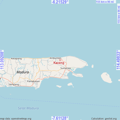
Kaceng GPS coordinates[2]
6° 54' 49.68" South, 113° 47' 42.72" East
| Map corner | latitude | longitude |
|---|---|---|
| Upper-left | -6.21529°, | 113.09208° |
| Center: | -6.9138°, | 113.7952° |
| Lower-right: | -7.61128°, | 114.49833° |
| Map W x H: | 155.2×155.2 km | = 96.4×96.4mi |
| max Lat: | 5.88969° ⇑28.3% North |
| Kaceng: | -6.9138° |
| min Lat: | ⇓71.7% South -10.934° |
| min Long | Kaceng | max Long |
| 95.1345° | 113.7952° | 140.9419° |
| W 65.5%⇐ | ⇒34.5% E |
Elevation
Elevation of Kaceng is 99 m = 325 ft, and this is 130.7 m = 429 ft below average elevation for this country.
| Max E: |
3185 m = 10449 ft | 50.8% |
| Avg. | 229.7 m = 754 ft | |
| Kaceng | 99 m = 325 ft | |
Min E: |
-1 m = -3 ft | 49.2% |
See also: Indonesia elevation on elevation.city.
Geographical zone
Kaceng is located in South Torrid zone (between Equator and Tropic of Capricorn). Distance of Equator is 768.7 km =477.6 mi to North.| Distance of | km | miles | from Kaceng |
|---|---|---|---|
| Equator | 768.7 | 477.6 | to North |
| Tropic Capricorn | 1837.2 | 1141.6 | to South |
| Antarctic Circle | 6632.4 | 4121.2 | to South |
| South Pole | 9238.3 | 5740.4 | to South |


Nearby cities:
15 places around Kaceng: (largest is in red/bold)
• Ares Tengah
3.1 km =1.9 mi,  325°
325°
• Bata Tengah
2.2 km =1.4 mi,  294°
294°
• Betangan
2.3 km =1.4 mi,  22°
22°
• Daja
2.1 km =1.3 mi,  105°
105°
• Daja
4 km =2.5 mi,  174°
174°
• Dajalorong
3.9 km =2.4 mi,  228°
228°
• Dasuk
2.5 km =1.6 mi,  56°
56°
• Gunong
2.3 km =1.4 mi,  221°
221°
• Keles Timur
3.1 km =1.9 mi, 228°
• Korbak
3.2 km =2 mi,  50°
50°
• Laok
2.8 km =1.7 mi,  164°
164°
• Lebak
3.2 km =2 mi,  340°
340°
• Nyapar
4.1 km =2.5 mi,  77°
77°
• Tajan
1.9 km =1.2 mi, 344°
• Tengah
1.6 km =1 mi,  192°
192°
Sources, notices
• [Note1] Compared only with cities in Indonesia existing in our database
• [Src1] Map data: © OpenStreetMap contributors (CC-BY-SA)
• [Src2] Other city data from geonames.org with taken over terms of usage.
• [Src3] Geographical zone / Annual Mean Temperature by Robert A. Rohde @ Wikipedia
