Tuanalepe geodata
Tuanalepe (East Nusa Tenggara) is a seat of a fourth-order administrative division; located in Indonesia in Asia/Makassar (GMT+8) time zone. In our database, there are 407 cities with bigger population. Compared to other cities in Indonesia, 96.5% of cities are located further ↑North; 95.5% of cities are located further ←West and 87.2% of cities have lower elevation than Tuanalepe. Note1


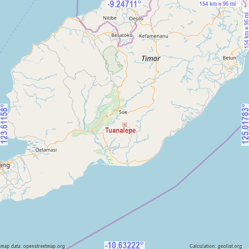
Tuanalepe GPS coordinates[2]
9° 56' 25.44" South, 124° 18' 52.92" East
| Map corner | latitude | longitude |
|---|---|---|
| Upper-left | -9.24711°, | 123.61158° |
| Center: | -9.9404°, | 124.3147° |
| Lower-right: | -10.63222°, | 125.01783° |
| Map W x H: | 154×154 km | = 95.7×95.7mi |
| max Lat: | 5.88969° ⇑96.5% North |
| Tuanalepe: | -9.9404° |
| min Lat: | ⇓3.5% South -10.934° |
| min Long | Tuanalepe | max Long |
| 95.1345° | 124.3147° | 140.9419° |
| W 95.5%⇐ | ⇒4.5% E |
Elevation
Elevation of Tuanalepe is 560 m = 1837 ft, and this is 330.3 m = 1084 ft above average elevation for this country.
| Max E: |
3185 m = 10449 ft | 12.8% |
| Tuanalepe | 560 m 1837 ft | |
| Avg. | 229.7 m = 754 ft | |
Min E: |
-1 m = -3 ft | 87.2% |
See also: Indonesia elevation on elevation.city.
Geographical zone
Tuanalepe is located in South Torrid zone (between Equator and Tropic of Capricorn). Distance of Equator is 1105.3 km =686.8 mi to North.| Distance of | km | miles | from Tuanalepe |
|---|---|---|---|
| Equator | 1105.3 | 686.8 | to North |
| Tropic Capricorn | 1500.7 | 932.5 | to South |
| Antarctic Circle | 6295.9 | 3912.1 | to South |
| South Pole | 8901.8 | 5531.3 | to South |


Nearby cities:
15 places around Tuanalepe: (largest is in red/bold)
• Belua
6.9 km =4.3 mi,  83°
83°
• Kampungbaru
9.4 km =5.8 mi,  336°
336°
• Mnelalete
6.1 km =3.8 mi,  356°
356°
• Naensaet
5.4 km =3.4 mi,  160°
160°
• Neonmat
7.4 km =4.6 mi,  14°
14°
• Nunumeu Timur
8.8 km =5.5 mi,  348°
348°
• Oebesa
8.6 km =5.3 mi, 341°
• Oekamusa
7.4 km =4.6 mi, 352°
• Oekefan
9.3 km =5.8 mi, 343°
• Oemanu
3.8 km =2.4 mi,  296°
296°
• Oepuah
7.8 km =4.8 mi, 350°
• Oepula
7.9 km =4.9 mi,  17°
17°
• Pusu
4.9 km =3 mi, 7°
• Rote
9.3 km =5.8 mi,  332°
332°
• Tuaneten
7.7 km =4.8 mi,  214°
214°
Sources, notices
• [Note1] Compared only with cities in Indonesia existing in our database
• [Src1] Map data: © OpenStreetMap contributors (CC-BY-SA)
• [Src2] Other city data from geonames.org with taken over terms of usage.
• [Src3] Geographical zone / Annual Mean Temperature by Robert A. Rohde @ Wikipedia
