Bestamuti geodata
Bestamuti (East Nusa Tenggara) is a seat of a fourth-order administrative division; located in Indonesia in Asia/Makassar (GMT+8) time zone. In our database, there are 407 cities with bigger population. Compared to other cities in Indonesia, 94.1% of cities are located further ↑North; 95.4% of cities are located further ←West and 96.3% of cities have lower elevation than Bestamuti. Note1


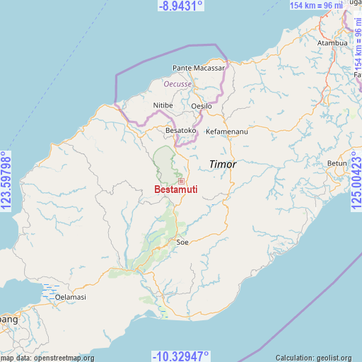
Bestamuti GPS coordinates[2]
9° 38' 13.2" South, 124° 18' 3.96" East
| Map corner | latitude | longitude |
|---|---|---|
| Upper-left | -8.9431°, | 123.59798° |
| Center: | -9.637°, | 124.3011° |
| Lower-right: | -10.32947°, | 125.00423° |
| Map W x H: | 154.1×154.2 km | = 95.8×95.8mi |
| max Lat: | 5.88969° ⇑94.1% North |
| Bestamuti: | -9.637° |
| min Lat: | ⇓5.9% South -10.934° |
| min Long | Bestamuti | max Long |
| 95.1345° | 124.3011° | 140.9419° |
| W 95.4%⇐ | ⇒4.6% E |
Elevation
Elevation of Bestamuti is 898 m = 2946 ft, and this is 668.3 m = 2193 ft above average elevation for this country.
| Max E: |
3185 m = 10449 ft | 3.7% |
| Bestamuti | 898 m 2946 ft | |
| Avg. | 229.7 m = 754 ft | |
Min E: |
-1 m = -3 ft | 96.3% |
See also: Indonesia elevation on elevation.city.
Geographical zone
Bestamuti is located in South Torrid zone (between Equator and Tropic of Capricorn). Distance of Equator is 1071.5 km =665.8 mi to North.| Distance of | km | miles | from Bestamuti |
|---|---|---|---|
| Equator | 1071.5 | 665.8 | to North |
| Tropic Capricorn | 1534.4 | 953.4 | to South |
| Antarctic Circle | 6329.6 | 3933 | to South |
| South Pole | 8935.5 | 5552.3 | to South |


Nearby cities:
15 places around Bestamuti: (largest is in red/bold)
• Beskolen
6.2 km =3.9 mi,  203°
203°
• Besnakeh
5.9 km =3.7 mi,  211°
211°
• Bijeli
4.9 km =3 mi,  134°
134°
• Bijeli
8.5 km =5.3 mi,  103°
103°
• Binab
6.1 km =3.8 mi,  348°
348°
• Bosen
9.2 km =5.7 mi,  188°
188°
• Fatumnasi
8.8 km =5.5 mi,  259°
259°
• Laob
8.6 km =5.3 mi,  141°
141°
• Oehala
7.7 km =4.8 mi,  229°
229°
• Oemollo
9.4 km =5.8 mi, 211°
• Oenam
5.7 km =3.5 mi,  35°
35°
• Oesena
9.2 km =5.7 mi, 352°
• Suanae
8.8 km =5.5 mi,  23°
23°
• Tobu
2.7 km =1.7 mi, 211°
• Tutem
4.4 km =2.7 mi,  242°
242°
Sources, notices
• [Note1] Compared only with cities in Indonesia existing in our database
• [Src1] Map data: © OpenStreetMap contributors (CC-BY-SA)
• [Src2] Other city data from geonames.org with taken over terms of usage.
• [Src3] Geographical zone / Annual Mean Temperature by Robert A. Rohde @ Wikipedia
