Somorpenang geodata
Somorpenang (East Java) is a seat of a fourth-order administrative division; located in Indonesia in Asia/Jakarta (GMT+7) time zone. In our database, there are 407 cities with bigger population. Compared to other cities in Indonesia, 66.7% of cities are located further ↓South; 67.7% of cities are located further ←West and 81.9% of cities have higher elevation than Somorpenang. Note1


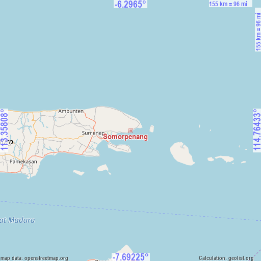
Somorpenang GPS coordinates[2]
6° 59' 41.64" South, 114° 3' 40.32" East
| Map corner | latitude | longitude |
|---|---|---|
| Upper-left | -6.2965°, | 113.35808° |
| Center: | -6.9949°, | 114.0612° |
| Lower-right: | -7.69225°, | 114.76433° |
| Map W x H: | 155.2×155.2 km | = 96.4×96.4mi |
| max Lat: | 5.88969° ⇑33.3% North |
| Somorpenang: | -6.9949° |
| min Lat: | ⇓66.7% South -10.934° |
| min Long | Somorpenang | max Long |
| 95.1345° | 114.0612° | 140.9419° |
| W 67.7%⇐ | ⇒32.3% E |
Elevation
Elevation of Somorpenang is 17 m = 56 ft, and this is 212.7 m = 698 ft below average elevation for this country.
| Max E: |
3185 m = 10449 ft | 81.9% |
| Avg. | 229.7 m = 754 ft | |
| Somorpenang | 17 m = 56 ft | |
Min E: |
-1 m = -3 ft | 18.1% |
See also: Indonesia elevation on elevation.city.
Geographical zone
Somorpenang is located in South Torrid zone (between Equator and Tropic of Capricorn). Distance of Equator is 777.8 km =483.3 mi to North.| Distance of | km | miles | from Somorpenang |
|---|---|---|---|
| Equator | 777.8 | 483.3 | to North |
| Tropic Capricorn | 1828.2 | 1136 | to South |
| Antarctic Circle | 6623.4 | 4115.6 | to South |
| South Pole | 9229.3 | 5734.8 | to South |


Nearby cities:
15 places around Somorpenang: (largest is in red/bold)
• Ares Tengah
5.9 km =3.7 mi,  54°
54°
• Budagan
2.4 km =1.5 mi,  63°
63°
• Bungin-Bungin
6.7 km =4.2 mi,  19°
19°
• Daja Lorong
3.1 km =1.9 mi,  31°
31°
• Dungkek
4.2 km =2.6 mi, 62°
• Dungkek Laok
3.3 km =2.1 mi, 53°
• Ginyang
2.7 km =1.7 mi,  0°
0°
• Girsereng
3.9 km =2.4 mi,  250°
250°
• Jurangara
5.6 km =3.5 mi,  295°
295°
• Ngabungan
5.6 km =3.5 mi,  317°
317°
• Patandun
1 km =0.6 mi,  257°
257°
• Petong
4.6 km =2.9 mi, 301°
• Poja
4.7 km =2.9 mi, 321°
• Polay
6.6 km =4.1 mi,  268°
268°
• Sekolan
5.9 km =3.7 mi,  333°
333°
Sources, notices
• [Note1] Compared only with cities in Indonesia existing in our database
• [Src1] Map data: © OpenStreetMap contributors (CC-BY-SA)
• [Src2] Other city data from geonames.org with taken over terms of usage.
• [Src3] Geographical zone / Annual Mean Temperature by Robert A. Rohde @ Wikipedia
